Drone Rules in Map2Fly
As of today, the amendment to the Air Traffic Act is valid. For all drone pilots, this means following the new regulations. All new map info can be found in the Map2Fly!
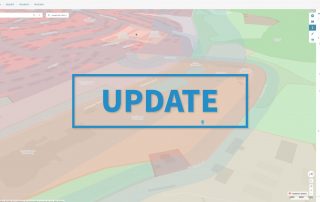
As of today, the amendment to the Air Traffic Act is valid. For all drone pilots, this means following the new regulations. All new map info can be found in the Map2Fly!
From now on you can import KML files into Map2Fly projects. The new import function is now available to all users of the FlyNex Enterprise Suite and Map2Fly Pro.

L'uso dei droni si è evoluto negli ultimi anni. Sempre più imprese li utilizzano per i loro scopi commerciali. In settori che vanno dalla silvicoltura, agricoltura, edilizia fino al controllo di strade e reti energetiche.

In the second part of our blog series we show you what drones are nowadays already capable of.
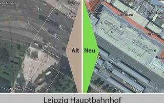
The new digital orthophotos for Brandenburg are visible on Map2Fly. The improved aerial photos allow a better orientation and flight planning in the web and mobile version of Map2Fly.
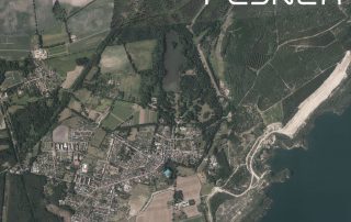
Since November the new digital orthophotos for Saxony are visible on Map2Fly. The improved aerial photos allow a better orientation and flight planning in the web and mobile version of Map2Fly.

More than 50% off! On Black FlyDay FlyNex has two offers for drone pilots. Save again with the license to fly on the last Friday in November. Get your drone driver's license and take off with an “Map2Fly_Pro Unlimited” account.
UAV pilots, i.e. pilots of Unmanned Aerial Vehicles, are increasingly in demand. Meanwhile, pilots can also earn good money. But what should you know as a drone pilot?

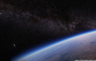
Drone Technology has been riding a wave of success in recent years - largely due to private users. But the real boom is still ahead of us, and according to a recent study by BDL and BDLI, the commercial sector will be its main focus.

Some farmers already use drones in their daily work as we already explained in our blog post on June 18th. In this article we would like to dig deeper into the usage of drones for saving fawns.