Bei über 10 Millionen Abfragen durch Nutzer auf der Map2Fly, stellt sich irgendwann die Frage, wofür eigentlich Drohnen am Himmel inzwischen eingesetzt werden? Im ersten Teil ging es um die Entwicklung des Drohnenmarktes in Deutschland und der EU. Heute, im zweiten Teil, möchten wir uns die Anwendungsbereiche von Drohnen anschauen.
Wozu Drohnen genutzt werden
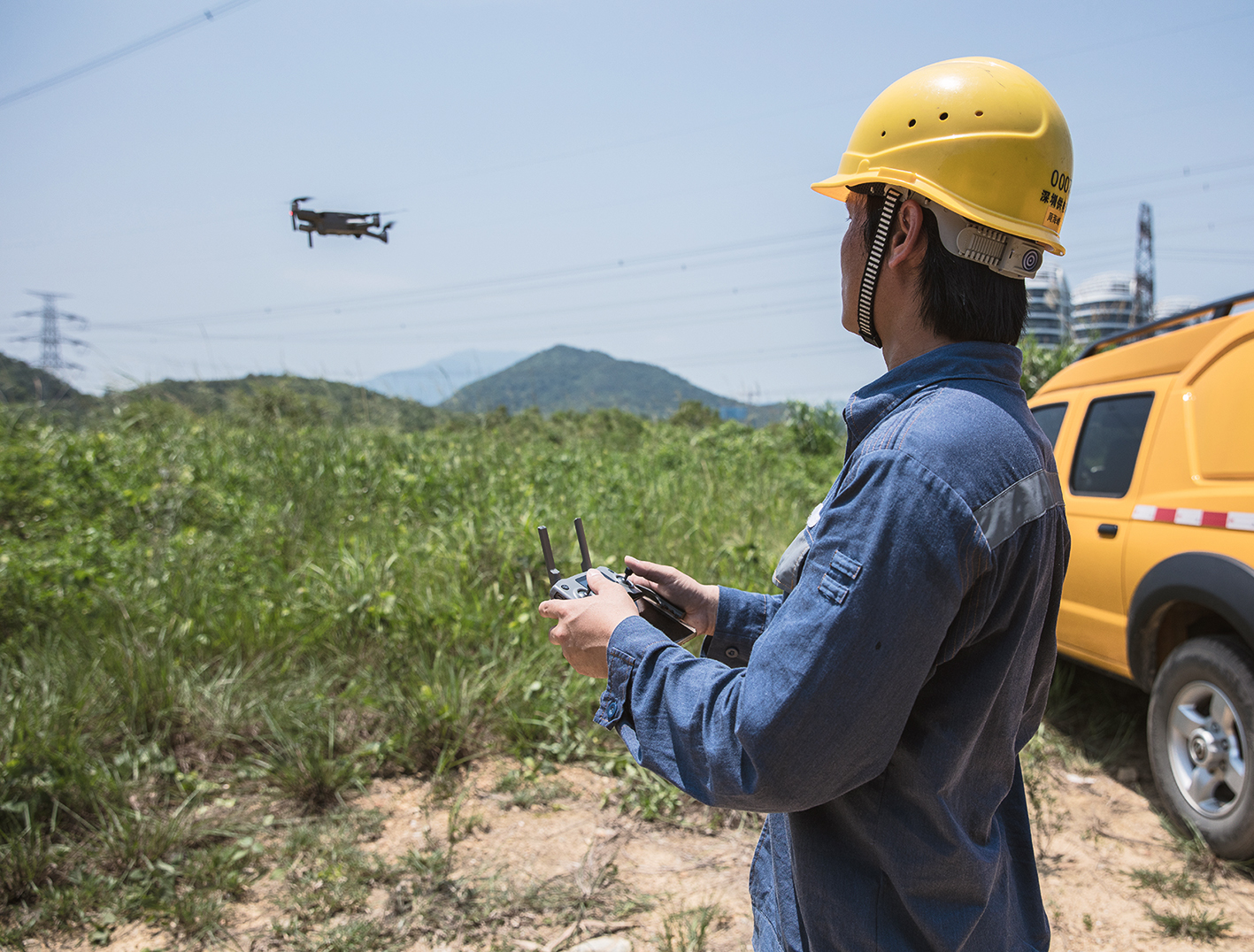
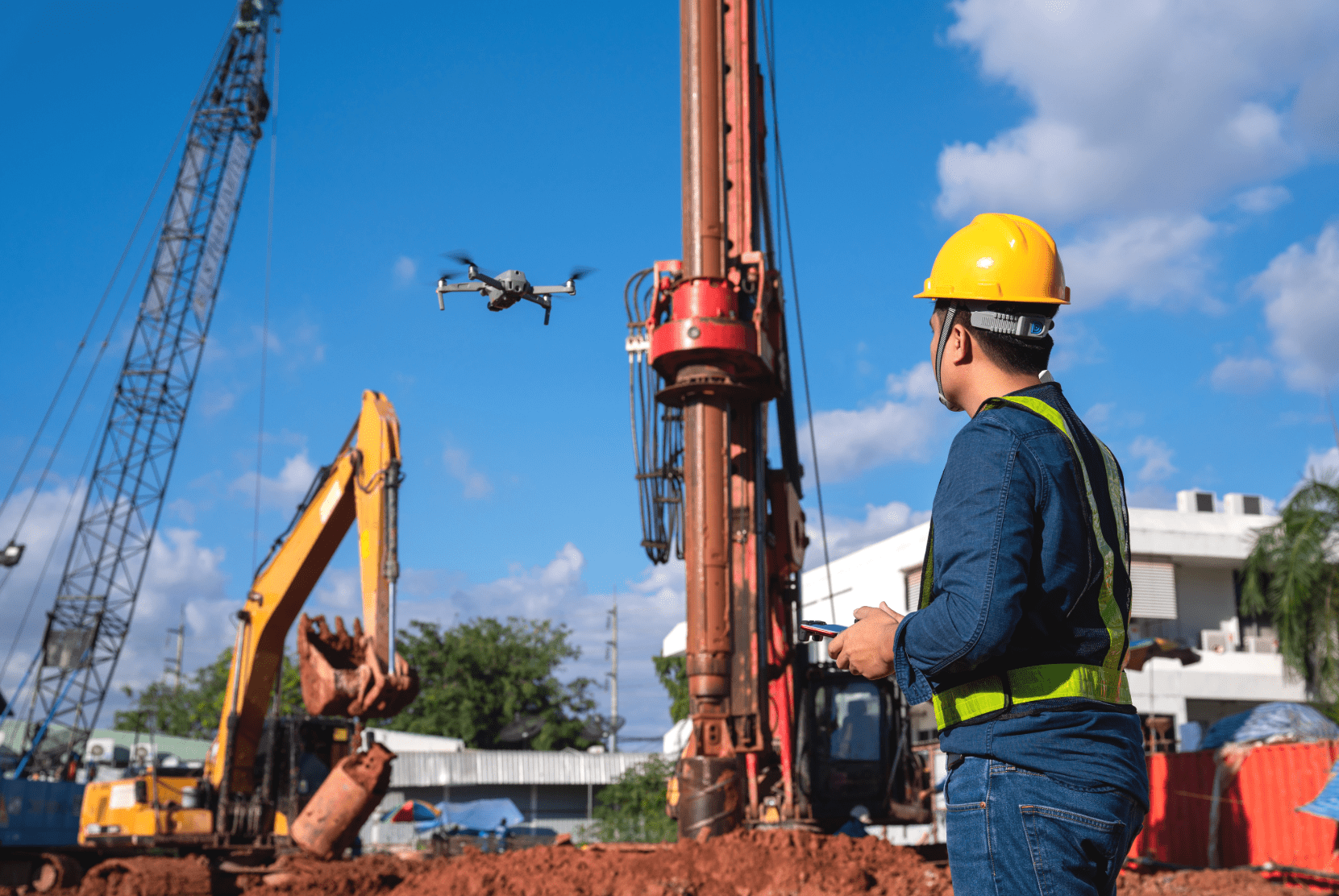
Besonders beliebt sind Drohnen für Vermessungs- und Inspektionsaufgaben. Auf Baustellen werden beispielsweise Flächen und Volumen berechnet, um die Menge von Baumaterial oder die Anzahl von LKW-Fahrten zu errechnen. Moderne Energiekonzerne hingegen inspizieren heutzutage ihre Strommasten per UAS statt Hubschrauber. Die Masten werden auf Schäden und Vogelnester geprüft. Hier erfahren Sie mehr darüber.
Dein Freund und Helfer – Inzwischen auch mit Drohne
Auch sogenannte B. O. S. (Behörden und Organisationen mit Sicherheitsaufgaben) ziehen ihre Vorteile aus den Fluggeräten. Mit Spezialkameras ausgestattet können sie enorm hilfreich bei der Personensuche oder Feuerbekämpfung sein. Wenn Sie das Thema interessiert, sehen Sie doch gerne mal in diesen Blogartikel.
Fliegende Augen für neue Perspektiven
Mit Drohnen wird auch Film- und Fotomaterial erstellt. Das kann sehr beeindruckend sein und wird immer häufiger in der Filmindustrie eingesetzt.
In der Agrarwirtschaft werden die unbemannten Fluggeräte zur Bodenflächen- und Pflanzenanalyse genutzt. Mit Wärmebildkameras lässt sich der Reifegrad der Pflanzen und Getreidearten erschließen. Zudem können auch Schädlinge gezielt bekämpft werden. Dazu nutzen Landwirte spezielle Spritz-Drohnen. Hier ein interessanter Artikel zum Thema.
UAS kommen außerdem vermehrt zur Beobachtung von Gebieten und Baustellen und zur Kartierung zum Einsatz.
Ein besonders bekanntes Beispiel hierfür ist die Rehkitzrettung per Drohne. Dazu werden die Felder der Landwirte per Drohnen mit Infrarotkameras durchsucht. So sind die kleinen Rehkitze schnell zu entdecken und können vor den Mähdreschern gerettet werden.
Drohnen als Arzt-Helfer – In Ruanda Realität
Grundsätzlich haben Drohnen viele Vorteile: Sie benötigen weniger Personaleinsatz, sind günstiger, oft schneller und können für den Menschen gefährliche Aufgaben übernehmen, wie beispielsweise eine Dachinspektion.
Im Kleinstaat Ruanda, Afrika, werden Drohnen längst als gängiges Transportmittel genutzt. Die dortige Infrastruktur und momentane Gesetzeslage begünstigten die Einführung der Drohnen als Lieferer für schlecht angebundene Gebiete und Krankenhäuser.
Es werden Blut- und Plasmakonserven, aber auch Medikamente und Impfstoffe transportiert.
Hier in Hamburg haben wir das auch schon getestet. In diesem Blogbeitrag erfahren Sie mehr über unser Medifly-Hamburg-Projekt:
Nächste Woche stellen wir Ihnen die Menschen vor, welche die kleinen Alleskönner professionell bedienen.
Bis nächste Woche,
Ihr FlyNex Team