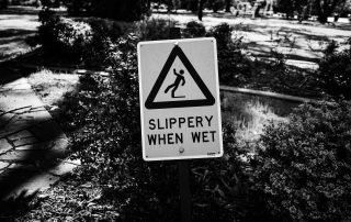
Verkehrssicherungspflicht in der Immobilienwirtschaft
Die Verkehrssicherungspflicht ist besonders in der Immobilienwirtschaft ein Thema, das eine unbestreitbare Relevanz besitzt. Wir erklären, warum Vorsicht besser als Nachsicht ist und wie dem steigenden Bedarf an Dach- und Fassadeninspektionen nachgekommen werden kann.
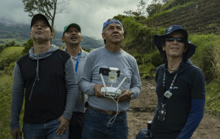
Mit Drohne und KI gegen die Folgen des Klimawandels
Wie lassen sich die Folgen des Klimawandels so eindämmen, dass die Versorgungssicherheit zahlreicher Menschen zukünftig weiter gewährleistet werden kann? Gemeinsam mit FlyNex unterstützen APD und FAO lateinamerikanische Landwirt/-innen dabei, Agrarflächen digitalisiert zu analysieren, um Ernteausfälle verhindern zu können.
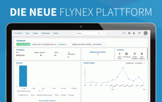
Die neue FlyNex Plattform ist da
Die neue FlyNex Plattform ist da! Wir haben unsere Software für Sie optimiert und starten mit einer kostenfreien 30-tägigen Testphase.
Mit FlyNex und Drone Harmony zu automatisierten Drohnenflügen
Die automatisierte Datengeneration per Drohne wird zukünftig noch einfacher, denn FlyNex und Drone Harmony geben ihre Partnerschaft bekannt.
Live Video- und Daten-Stream von Drohnen
Mit FlyNex und KSI Data Sciences lassen sich Videobild- oder Messdaten von Drohnen in Echtzeit streamen. Unabhängig vom Standort oder Gerät. Damit können Teams ganze Fern-Inspektionen zeitgleich und ortsunabhängig durchführen.

Datenerfassung mit Drohne – Wie steht es um den Datenschutz?
Wie gestaltet sich Datensicherheit beim Einsatz von Drohnen und der luftbasierten Datenerfassung? Der Schutz der Datenübertragung und Verwaltung ist zwar technisch komplex, aber durch den integrierten Ansatz von FlyNex auf der Plattform zentral zu steuern.
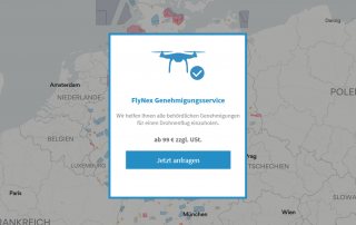
Mit FlyNex zur Aufstiegsgenehmigung
FlyNex hilft jetzt bei der Beantragung einer Aufstiegsgenehmigung. Egal wie komplex, egal wie kompliziert.

Checklisten: Das Drohnen 1×1
Alle Genehmigungen sind eingeholt, der Pilot ist vor Ort, die Anwohner sind benachrichtigt, aber keiner hat den Akku geladen? Mit guten Checklisten kann Ihnen das nicht passieren. FlyNex zeigt was eine gute Checkliste ausmacht.

Neues Feature für Map2Fly Pro und Enterprise
Ab jetzt können Sie KML-Dateien in Map2Fly-Projekte importieren. Die neue Import-Funktion steht ab sofort allen Nutzern der FlyNex Enterprise Suite und Map2Fly Pro zur Verfügung.
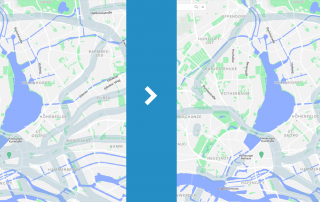
Keine Untergrundgleise mehr in der Map2Fly
Neues Kartenupdate in unserer Map2Fly. In Hamburg haben wir die eingezeichneten Bahntrassen, die unterirdisch verlaufen entfernt.