Einige Landwirte nutzen Drohnen in ihrer täglichen Arbeit, da diese erhebliche Vorteile liefern, wie wir bereits herausgestellt haben. Insbesondere die Nutzung von Drohnen für die Rettung von Rehkitzen ist momentan in aller Munde.
Durch den Einsatz von Drohnen sind in Deutschland bereits unzählige Rehkitze vor dem Tod bewahrt worden
Wenn Landwirte ihre Felder mähen wollen, sollten sie dies von innen nach außen tun, um die Tiere, die sich dort im hohen Gras verstecken, wegzuscheuchen. Zusätzlich unterstützen Jäger und andere Helfer dabei, indem Sie die Felder vor dem Mähen abgehen.
Erwachsene Rehe und andere Tiere flüchten, aber bei Rehkitzen funktioniert diese Technik nicht. Sie haben keinen Fluchtinstinkt und bleiben einfach im hohen Gras liegen. Dies macht sie noch schwerer auffindbar. Hinzu kommt, dass sie die Betriebsgeräusche der Mähdrescher ebenfalls nicht als Gefahr sehen. Deshalb sterben in Deutschland unzählige Rehkitze jährlich. Für Landwirte ist dies auch rechtlich ein Problem, da sie hierfür empfindliche Geldstrafen zahlen müssen.
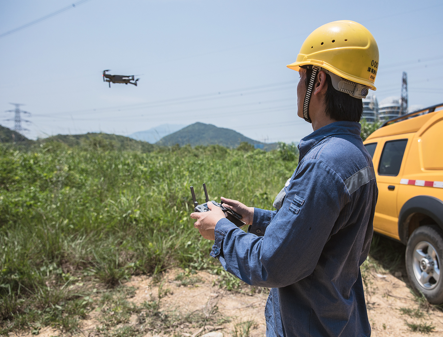
Das Abgehen eines Feldes ist zeitaufwändig und das Einsetzen von Jägern und anderen Helfern zudem ein finanzieller und organisatorischer Aufwand. Um die Vorbereitungszeit für das Mähen zu reduzieren, wurden schließlich Drohnen zur Befliegung der Felder eingesetzt. Anfangs waren die Drohnen jedoch nur mit einer herkömmlichen RGB-Kamera ausgestattet, was leider nur teilweise zum Erfolg führte.
Drohnen mit thermografischen Kameras helfen am besten
Erst der Einsatz von professionellen Drohnen mit Wärmebildkameras konnte wirklich zum Erfolg führen. Diese können die Felder in sehr kurzer Zeit abfliegen und durch den Temperaturunterschied zwischen kaltem Feld und warmen Tier sind die Rehkitze auch in dicht bewachsenen Feldern gut erkennbar.
Helfer können die exakte Position der Rehkitze anhand der Aufnahmen zuverlässig finden und so die Tiere in Sicherheit bringen, bevor der Mähdrescher durchs Feld pflügt. Die Drohneneinsätze müssen jedoch trotzdem sehr früh morgens stattfinden, da sonst der Boden unter Umständen zu warm wird und dadurch ein Auffinden der Tiere erschwert wird.
Der Erfolg weitet sich aus
Mittlerweile gibt es Erfolgsgeschichten zur Rehkitzrettung mit Drohnen aus ganz Deutschland. Einige Beispiele für erfolgreiche Rettungen sind Attendorn in Nordrhein-Westfalen, Teunz in Bayern, Hohenmölsen in Sachsen-Anhalt, sowie Neustadt in Niedersachsen. Aber auch in Holland und der Schweiz werden Drohnen bereits erfolgreich eingesetzt.
Wir sind sehr erfreut, dass der Einsatz von Drohnen bereits unzählige Tiere vor dem sicheren Tod bewahren konnte und hoffen, dass dies noch ausgeweitet wird.
Drohnenpiloten sind häufig ehrenamtlich im Einsatz
Neben den vorbildlich handelnden Landwirten ist besonders der Einsatzwille der Drohnenpiloten hervorzuheben. Diese bieten ihre Dienste häufig ehrenamtlich an und agieren zum Wohle der Tiere. Da insbesondere der Einsatz von Drohnen mit Wärmebildkameras zum Erfolg führt, sei anzumerken, dass diese Geräte nahezu ausschließlich aus dem professionellen Bereich stammen. Dementsprechend übersteigen die Preise dieser professionellen Drohnen die von Freizeitdrohnen um ein Vielfaches.
Unser Beitrag für die Rettung von Rehkitzen
Wir haben uns überlegt, die Drohnenpiloten zu honorieren und sie bei ihrer Arbeit zu unterstützen.
Daher möchten wir allen Drohnenpiloten, die bei der Rehkitzrettung helfen, etwas schenken:
Eine 1-Jahreslizenz für MAP2FLY_PRO Unlimited für die ersten 10 Drohnenpiloten, die sich bei uns melden.
Voraussetzungen für den Erhalt der Lizenz
- Nachweislich bereits an Rehkitzrettungen beteiligt gewesen
- Alternativ: Mitgliedschaft in einem der zahlreichen Fördervereine zur Rehkitzrettung für alle Piloten, die noch nicht lange dabei sind und bisher noch keine eigenen Einsätze geflogen sind
Die Lizenz ist ab Erhalt kostenlos für ein Jahr gültig. Für das Verwenden der Software ist ein Zugang zum Internet und ein Browser notwendig. Auch erhältlich als App für iOS und Android. Zur Nutzung der Lizenz ist eine Registrierung auf https://map2fly.flynex.de/ erforderlich.
Wie MAP2FLY bei der Rehkitzrettung helfen kann
Durch unsere Geodaten aus über 165 validen Quellen erhält der Benutzer direkt bei der Flugplanung eine Übersicht über die Auflagen und Gesetze, die auf der jeweiligen Route herrschen. Drohnenpiloten erhalten innerhalb von wenigen Klicks eine Übersicht über alles, was sie bei ihrem Flug beachten müssen. Nicht jeder Pilot weiß, wie er sich verhalten soll, wenn in unmittelbarer Nähe zum befliegendem Feld Strommasten, Autobahnen oder Landstraßen entlangführen. Es gibt so viele Dinge, auf die geachtet werden muss, wenn man Regel- und Gesetzeskonform fliegen möchte, dass eine Flugplanung immens wichtig ist. MAP2FLY bietet dem Piloten die Möglichkeit, sich vorab über alle Gesetze und Regeln zu informieren. Plant man den Flug so, dass alle Auflagen erfüllt werden, ist es auch ein Leichtes, eine Genehmigung der zuständigen Landesluftfahrtbehörde zu erhalten, wenn die Drohne mehr als 5 kg wiegt oder kommerziell genutzt wird. Da Einsätze bei Landwirten oft zeitnah vorher telefonisch angemeldet werden, ist eine einfache und schnelle Flugplanung unabdingbar. Genau hierbei hilft MAP2FLY.
MAP2FLY_PRO Unlimited bietet folgende Vorteile gegenüber der kostenfreien Variante:
- Speicherung einer unbegrenzten Anzahl an Projekten
- Bis zu 3 Drohnen mit insgesamt 9 Akkus können verwaltet werden
- Der verfügbare Speicherplatz beträgt 5 GB
Die Software kann neben der Rehkitzrettung selbstverständlich auch für alle anderen Einsatzzwecke eingesetzt werden.
Wer schon einen Blick vorab in unsere Karte werfen möchte, kann gerne kostenlos Map2Fly_Pro testen.
Vorgehensweise für Drohnenpiloten
Wir bitten interessierte Piloten, sich einfach per E-Mail an info@flynex.de zu wenden.
Alles Weitere erfolgt dann im direkten Austausch mit unserem Service-Team.
Wir hoffen, dass unsere Software ihren Teil dazu beitragen kann, die Landwirtschaft auf eine umweltschonende und effiziente Weise weiter voranzutreiben. Wenn dabei auch noch das Wohl der Rehkitze gewährleistet werden kann, umso besser!
Für alle Landwirte gibt es hier eine Liste von Drohnenpiloten, die bei der Rehkitzrettung helfen können.
Ihr FlyNex Team