Brief der Geschäftsführung
Corona betrifft uns alle. Hier können Sie die offizielle Stellungnahme unserer Geschäftsführung nachlesen.

Corona betrifft uns alle. Hier können Sie die offizielle Stellungnahme unserer Geschäftsführung nachlesen.

10 Millionen Abfragen auf unserer Map2Fly! 🥳 Das freut uns und zeigt: Es gibt immer mehr Drohnen in Deutschland und der EU. Warum ist das so? Wir geben Ihnen in den nächsten Wochen ein paar spannende Einblicke.

Das SORA-GER klingt nach Bürokratie, ist aber für jeden Drohnen-Piloten, egal ob privat oder gewerblich, unverzichtbar. Wir erklären Ihnen alles, was Sie über den Risikorechner wissen müssen.

In Brandenburg möchte Elon Musk eine weitere Gigafactory bauen. Ein spannendes Spektakel von Oben – wir informieren Sie über die rechtliche Lage zum Drohnenflug über das neue Tesla-Gelände.

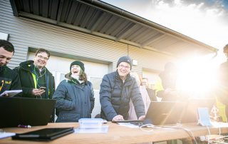
Die Map2Fly gefiel den Polizeistudenten und -studentinnen. Kein Wunder bei den Möglichkeiten, die Drohnen für den Einsatz bei Behörden und Organisationen mit Sicherheitsaufgaben (B. O. S.) bieten.
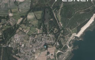
Die neuen Luftbilder von Brandenburg sind nun auch in unserer Map2Fly verfügbar. Hochauflösend erlauben die Aufnahmen eine fehlerfreie und detaillierte Flugplanung.

Der Sturmtief Sabine hinterließ in ganz Deutschland seine Spuren. Dächer, Bäume, Masten, Leitungen, Gelände – kaum etwas, was nicht durch den Orkan in Mitleidenschaft gezogen wurde. FlyNex bietet Hilfe aus der Luft: Kostenlos Schadensbild erstellen lassen. Wir kommen vorbei!
Statt mit Blaulicht durch den Verkehr, über die Dächer der Stadt: Medifly-Hamburg testete erstmalig Gewebetransporte zwischen zwei Krankenhäusern in einer Metropole.
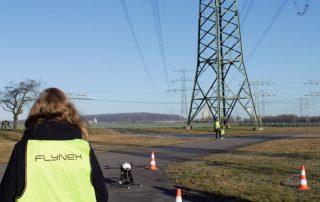
FlyNex inspizierte mit MITNETZ STROM zum ersten Mal in Deutschland voll automatisiert und mit Hilfe von künstlicher Intelligenz 70 Strommasten auf einer Strecke von 20 Kilometern mit einer Drohne.
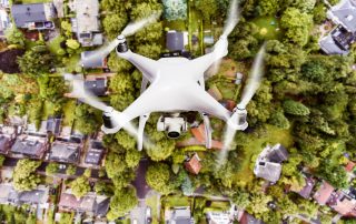
Ob Hobby-Pilot oder professioneller Drohnenflieger: Auch in der Luft gilt Privatsphäre und Datenschutz. Warum es wichtig ist, die Grundregeln für Drohnen zu kennen wieso es nicht nur Drohnen mit Kameras betrifft, wollen wir heute zum Europäischen Datenschutztag erklären.