Täglich begegnen uns Thermografien – in Form von Kartendarstellungen bei der Wettervorschau in den Fernsehnachrichten sicher am häufigsten. Weitere Einsatzzwecke im Fernsehkosmos sind Tierdokumentationen, um beispielsweise den Blick von Schlangen darzustellen. Ein anderer Anwendungsbereich ist die Humanmedizin.
In der Industrie werden Thermografien vor allem zur thermischen Inspektion von Gebäuden verwendet, da mit ihrer Hilfe Wärmeverluste an Wänden, Heizungen und Fenstern schnell und einfach visualisiert werden können. Vor allem bei Modernisierungen von bestehenden Gebäuden kommt diese Technik zum Einsatz, um Wärmeverluste aufzudecken. Die Energiewende bringt der Gesellschaft zudem ein Effizienzbewusstsein und bevor man in eine teure wärmedämmende Fenster- oder Dachsanierung investiert, sollte der Wärmeverlust inspiziert und der Bedarf einer solchen Sanierung ermittelt werden. Schließlich sind Heizungen und die Warmwasseraufbereitung die größten Energieverbraucher in einem deutschen Haushalt.
Wo wir gerade beim Thema Energiewende sind – auch bei Solar- und Photovoltaikanlagen werden Inspektionen und Wartungsvorbereitungen mit dem Thermografieverfahren durchgeführt.
Funktionsweise der Thermografie
Was steckt hinter den bunten Bildern, die wir jeden Abend beim Wetterbericht sehen?
Technisch handelt es sich bei den verwendeten Kameras um Wärmebildkameras, die Infrarotstrahlung aufzeichnen können. Die Temperatur von Objekten steht in Korrelation mit der Infrarotstrahlung, die diese aussenden. Die Temperaturunterschiede werden meist in verschiedenen Farben abgebildet, um einen Unterschied für das menschliche Auge darstellen zu können.
Das Besondere an sogenannten radiometrischen Thermografiekameras ist nicht nur die Bilderzeugung, sondern viel mehr die Möglichkeit der Speicherung der Temperatur jedes einzelnen Pixels. Der Grad der Aufzeichnung von Temperaturunterschieden ist daher sehr hoch. Daher unterscheidet sich auch die Auflösung dieser Kameras erheblich von der Auflösung gewöhnlicher RGB-Kameras – Die Datenmenge, die jeder Pixel liefert, ist schlichtweg viel höher.

Anwendungsbeispiel Photovoltaikanlage – Die Wellenlänge zählt
Bei der Infrarotstrahlung handelt es sich um eine Strahlung, die vom Menschen mit bloßem Auge nicht sichtbar ist. Der Infrarotbereich hat eine Wellenlänge von 700 nm bis 1 mm, also 1 Million nm (Nanometer). Das ist eine sehr große Strahlungsspanne und daher wird die Infrarotstrahlung in verschiedene Bereiche unterteilt, nämlich in nahes Infrarot, kurz-, mittel- und langwelliges Infrarot, sowie Ferninfrarot. Für den medizinischen Bereich wird sowohl das nahe Infrarot (vor allem in der Augenheilkunde), als auch das Ferninfrarot (Stimulation des Nerven- und Immunsystems) verwendet.
Für die thermografische Darstellung von PV-Anlagen und Gebäuden wird mit einem Spektrum von 8 nm bis 15 nm gearbeitet, dem langwelligen Infrarot. Im gezeigten Beispielbild einer Dachanlage werden die Temperaturunterschiede der verschiedenen Anlagenteile durch die thermographische Darstellung sichtbar. Dieses Beispiel stammt aus unserer neuesten Partnerschaft mit der Inspektionsfirma UCAIR, die uns freundlicherweise dieses Bild zur Verfügung gestellt hat.
Drohnen und Thermografie – der Game Changer für Inspektionen von Photovoltaikanlagen
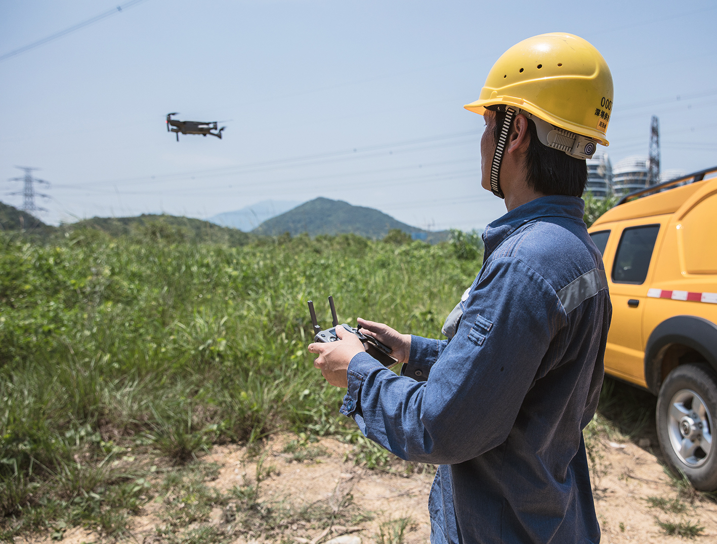
Wie man am Beispielbild vielleicht schon erkennt, handelt es sich um eine Luftaufnahme. Dieses Bild hat ein Pilot von UCAIR nicht kostspielig mit einem Helikopter, sondern natürlich mit einer Drohne aufgenommen!
Der Flugplan wurde vorher von einem Projektplaner bei UCAIR mit unserer Projektmanagentsoftware HORIZON erstellt.
Aufgrund unserer umfangreichen Geodaten konnte der Projektersteller direkt sehen, welche Regeln und Gesetze an diesem Ort gelten und konnte so mit wenigen Klicks direkt eine Flugroute planen, die vom Gesetzgeber genehmigt werden konnte.
Da HORIZON die Möglichkeit bietet, Projektdaten mit anderen zu teilen, bekam der Pilot die Flugroute innerhalb unserer Software übermittelt. Unsere Software ist cloudbasiert, somit musste der Pilot dafür nicht physisch im Unternehmen präsent sein. Nach dem Teilen durch den Projektmanager konnte er die Flugroute direkt in seinem Account finden.
Die beim Inspektionsflug generierten Thermaldaten wurden im Anschluss vom Drohnenpiloten in HORIZON hochgeladen. Diese Analyseeinbindung ist ein exklusives Feature unserer Enterprise-Lösung. Der zuständige Thermograf konnte diese Daten über seinen Account abrufen, um sie dann aufbereitet dem zugehörigen Kunden zur Verfügung zu stellen. Auch die Auswertung der Befliegung ist über unsere Software an den Kunden übermittelt worden.
Vorteile der Integration von HORIZON ENTERPRISE
UCAIR konnte durch die Integration unserer Software ihren Workflow deutlich verbessern. Gerade die Möglichkeit der cloudbasierten Datenfreigabe bietet dem Unternehmen einen enormen Zeitvorteil, da auf diese Weise Drohnenpiloten Deutschlandweit direkt ihre Flugrouten erhalten können. Dies erhöht den Aktionsradius dieses Dienstleisters immens, da die Drohnenpiloten dezentral arbeiten können. Ein weiterer Zeitvorteil wird dadurch geschaffen, dass die erhobenen Datensätze direkt an einen Thermografen übermittelt werden können, der diese dann auswerten kann. Die Daten können dann wiederum an den Kunden übermitteln werden. Das Reporting kann bei wiederkehrenden Inspektionen immer wieder zum Vergleich herangezogen werden und so entsteht eine kontinuierliche Protokollierung des Anlagenzustandes.
Vorteile von Drohnen bei Thermografien
Logischerweise ist ein Inspektionsflug mit einer Drohne günstiger, als mit einem Helikopter.
Der Drohneneinsatz ist aber auch günstiger, als ein Thermograf mit einem Handgerät. Dieser braucht im Vergleich zur Drohne viel länger, um eine ganze Anlage oder Gebäude zu inspizieren und muss für die entsprechende Zeit vergütet werden. Je größer die Anlage bzw. das Gebäude, umso größer auch der Zeit- und dadurch auch der Kostenvorteil der Drohne im Vergleich zum Thermografen mit Handgerät. Die bei der Inspektion mit Drohnen erzeugten Datensätze sind zudem detaillierter, da aus der Luft ein besserer Betrachtungswinkel eingenommen werden kann, als beispielsweise von einer Leiter. Zudem sinkt die Gefahr für den Thermografen, da er nicht mehr klettern muss. Defekte können dank dieser Inspektion frühzeitig erkannt werden und zukünftige Wartungen antizipiert werden (Predictive Maintenance).
Ausblick
Kürzlich stellte der französische Drohnenhersteller Parrot eine Drohne mit bereits ab Werk ausgestatteter Wärmebildkamera vor. Auch Branchenprimus DJI bietet ein solches Modell bereits seit Anfang 2019 an. Dies zeigt, dass das Thema Thermografie bereits heute ein fester Bestandteil der Drohnenindustrie ist. In Zukunft werden sicher immer mehr Modelle mit noch besseren Kameras folgen, sodass die Aufnahmequalität noch weiter steigt und im Idealfall der Anschaffungspreis weiter sinkt. Mit unserer Softwarelösung möchten wir Unternehmen dabei helfen, Drohnen in ihren Workflow zu integrieren, um deren gesamtes Potenzial gewinnbringend nutzen zu können.
Ihr FlyNex Team