First Medifly Testflight Successful
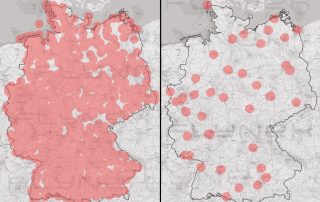
Instead of using blue light through the traffic, over the roofs of the city: Medifly-Hamburg tested tissue transports between two hospitals in a metropolis for the first time.
Instead of using blue light through the traffic, over the roofs of the city: Medifly-Hamburg tested tissue transports between two hospitals in a metropolis for the first time.
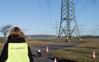
FlyNex and MITNETZ STROM inspected 70 power poles over a distance of 20 kilometers fully automated, with the help of artificial intelligence and a drone.
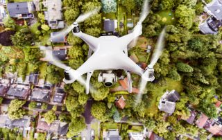
Whether hobby pilot or professional drone pilot: privacy and data protection also apply in the air. Why is it important to know the basic rules for drones and why it is not only about drones with cameras? Today, on Data Privacy Day, we will tell you!
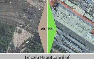
Since November the new digital orthophotos for Saxony are visible on Map2Fly. The improved aerial photos allow a better orientation and flight planning in the web and mobile version of Map2Fly.

More than 50% off! On Black FlyDay FlyNex has two offers for drone pilots. Save again with the license to fly on the last Friday in November. Get your drone driver's license and take off with an “Map2Fly_Pro Unlimited” account.

The Munich-based company Casavi offers housing companies and project developers a digital solution for the management and planning of real estate. Casavi and FlyNex illustrate in a joint webinar how drones can be used optimally.

At the end of October, FlyNex attended the 8th East German Energy Forum. The main topic of this year's forum was "Ways of a (sustainable) transformation of the German energy system - How East German economy and industry shape a successful energy turnaround."

UAV pilots, i.e. pilots of Unmanned Aerial Vehicles, are increasingly in demand. Meanwhile, pilots can also earn good money. But what should you know as a drone pilot?

Late summer is heating up again! Next month, three events of international importance will feature start-ups, drones and innovative business ideas. FlyNex will be there for all three.
While the first National Aviation Conference is taking place in Leipzig, the debate about new bans on drone flights near airports is making headlines.