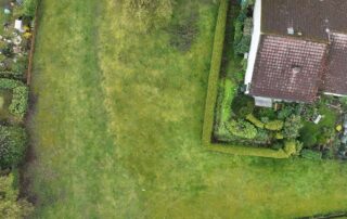
Digitale Quartiersvermessung
Die Digitale Quartiersvermessung mittels Drohnentechnologie ermöglicht eine präzise Bestandserfassung und effektive Flächenverwaltung, wodurch Unternehmen Kosten sparen, Transparenz erhöhen und nachhaltigere Entscheidungen treffen können.
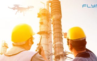
Mit Drohne und KI gegen die Folgen des Klimawandels
Wie lassen sich die Folgen des Klimawandels so eindämmen, dass die Versorgungssicherheit zahlreicher Menschen zukünftig weiter gewährleistet werden kann? Gemeinsam mit FlyNex unterstützen APD und FAO lateinamerikanische Landwirt/-innen dabei, Agrarflächen digitalisiert zu analysieren, um Ernteausfälle verhindern zu können.
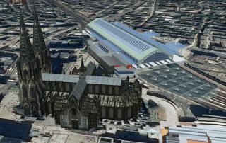
DaViLuS – Die erste 3D-Karte Deutschlands
Gemeinsam mit HERE Technologies hat FlyNex den deutschen Luftraum erstmalig in 3D kartiert. Das Ergebnis ist jetzt für alle sichtbar. Wir erklären, wieso und wie das Ganze zustande kam.
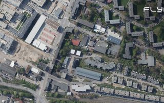
Keine Untergrundgleise mehr in der Map2Fly
Neues Kartenupdate in unserer Map2Fly. In Hamburg haben wir die eingezeichneten Bahntrassen, die unterirdisch verlaufen entfernt.
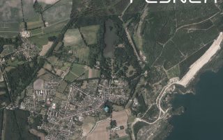
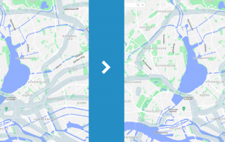
Neue Orthofotos für Brandenburg
Die neuen Luftbilder von Brandenburg sind nun auch in unserer Map2Fly verfügbar. Hochauflösend erlauben die Aufnahmen eine fehlerfreie und detaillierte Flugplanung.
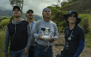
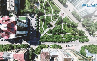
Hochmodern und immer häufiger zu sehen: Vermessungen mit Drohnen
Vermessungen mit Drohnen sind effizienter als die herkömmlichen Vermessungen vom Boden aus. In einem Interview mit Frank Lochau befassen wir uns mit der aktuellen Lage am Markt und er gibt uns einen Einblick in einen seiner letzten Vermessungsaufträge mit Drohne.
Geodaten – Wo kommen sie her und was ist das?
Von einfachen Wegbeschreibungen über Grundstücksdaten bis hin zu komplexen Fachthemen, wie die Risswerkaufnahme oder die Baufortschrittsdokumentation mit Drohnen: Geodaten begegnen uns bei der Arbeit oder im Alltag und sind in so ziemlich jeder Branche zu finden! Vorsicht: Nicht alle Geodaten sind zu gebrauchen! [ ... ]
GEODATEN: Wichtige Fakten für eine Zukunft mit Drohnen
Geodaten für unbemannte Luftfahrtsysteme Unbemannte Luftfahrtsysteme, umgangssprachlich oft Drohnen oder Copter genannt, werden rechtlich der Luftfahrt zugeordnet. Daher ist es relativ naheliegend, sich für den Aufstieg mit einem Gerät mit Aspekten der Luftfahrt auseinanderzusetzen. Für viele Piloten am Boden heisst [ ... ]
Noch nicht gefunden, wonach Sie gesucht haben?
Haben Sie Fragen zur Lösung von FlyNex oder einem geplanten Anwendungsfall? Oder würden Sie gerne eine unverbindliche Demo unserer Plattform bekommen, um zu erfahren, wie diese Sie in Ihren Prozessen unterstützen kann? Dann schreiben Sie uns!