Der Sachsenwald in Schleswig-Holstein: Rund 55 km² teils urbewaldete Fläche, die mit ihrer Weitläufigkeit und Idylle Anwohner/-innen und Tourist/-innen gleichermaßen anzieht. Was Freizeit-Wanderer/-innen verzückt, stellt die Firma claus rodenberg waldkontor gmbh vor einige Herausforderungen. Denn sie ist mit der Bewirtschaftung des Sachsenwaldes beauftragt und hat mit der Beseitigung der Sturmschäden von Zeynep und Co. in diesem Jahr besonders viel zu tun. Doch wie kann der Sachsenwald im Ganzen inspiziert werden, obwohl die Reviere der Förster viel zu groß sind, um sie zu Fuß zu begehen? Waldkontor testet hierfür gemeinsam mit FlyNex nachhaltige Methoden der Forstwirtschaft und setzt dabei auf Luftbilder und Künstliche Intelligenz (KI).
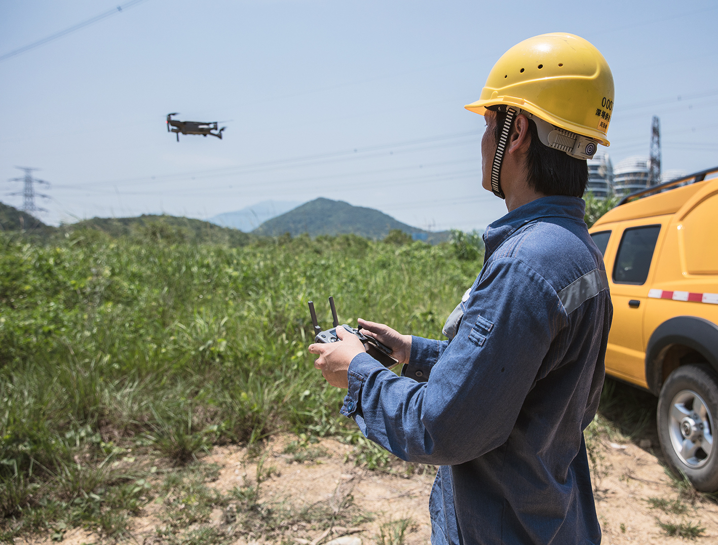
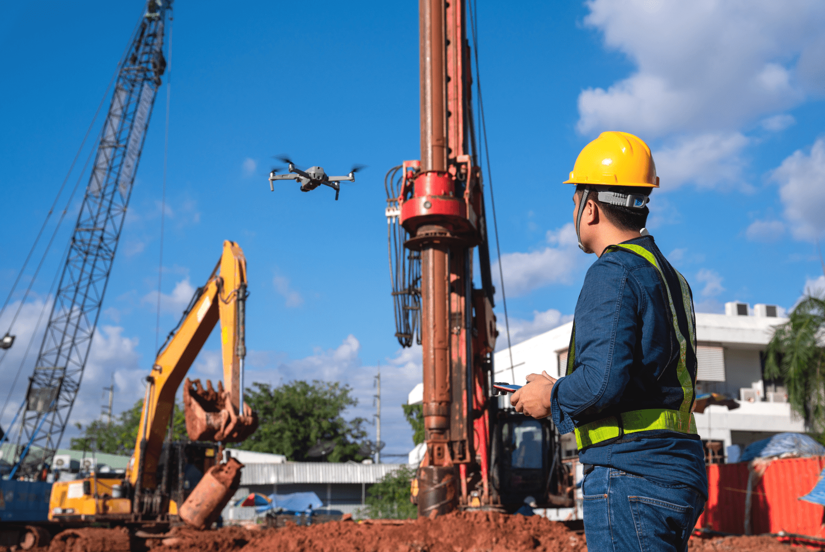
Erster kommerzieller Drohnenflug im Sachsenwald
Um schnell und zuverlässig einen Überblick über einen Ausschnitt des Sachsenwaldes zu erhalten, befliegt FlyNex im Auftrag von waldkontor erstmalig rund zwei Hektar Waldgebiet. Dabei nimmt die Drohne bei einem nur acht Minuten langen Flug insgesamt 166 hochauflösende Bilder in einer Flughöhe von 75 Metern auf. Ziel ist es, möglichst effizient per KI umgestürzte Bäume zu erkennen und dadurch die örtlichen Förster zu entlasten. Aufgrund der Weitläufigkeit ihrer Reviere blieben nämlich in der Vergangenheit entwurzelte Bäume teilweise unentdeckt und gaben Borkenkäfern ausreichend Platz zum Nisten. Ein Teufelskreis.


Waldinventur per Drohne
Durch den Einsatz von Drohnen und die Sammlung hochauflösender Bilddaten, kann waldkontor nun eine Inventur des Sachsenwaldes zeitsparend und zuverlässig aus der Luft vornehmen. Dafür erfassen die unbemannten Fluggeräte auch große und schwer zugängliche Areale in einem hohen Detailgrad. Mithilfe der gewonnenen Luftbilder werden digitale Karten erstellt, die den Baumbestand genau dokumentieren und analysieren. Auf diese Weise erhält waldkontor einen tagesaktuellen Eindruck vom Zustand des Waldes. Zudem können durch Künstliche Intelligenz Sturmschäden zuverlässig identifiziert und georeferenziert lokalisiert werden. Ergänzend lassen sich auch Volumina aus dem Büro heraus berechnen, sodass die Planung von Maschinen und Abfuhrkapazitäten punktgenau erfolgen kann.
Per KI Sturmschäden erkennen
Doch damit nicht genug: Bei der regelmäßigen Erhebung von Luftbildern können Zustandsentwicklungen erkannt werden, die die vorausschauende Ableitung forstwirtschaftlicher Maßnahmen ermöglichen. Nach der Befliegung des Sachsenwalds analysiert eine KI die gesammelten Bilder und liefert wertvolle Erkenntnisse für die Bewirtschaftung. Sturmschäden und Abgänge können zielgerichtet aufgespürt werden. Zudem wird den Waldbesitzer/-innen eine Unterscheidung zwischen gewünschten Entnahmen und Einschlägen möglich. Damit lässt sich schnell und zuverlässig eine Lagebild erzeugen. Nur wenige Bilder benötigte FlyNex für das Training der KI, um die Bedürfnisse des Kunden zu erfüllen. Bei der KI Technologieentwicklung arbeitet FlyNex mit DENKweit zusammen.


Ableitung vorausschauender Maßnahmen
Sofern mit RGB- und Multispektralkameras ausgestattete Drohnen zum Einsatz kommen, können Daten erhoben werden, die sich für die Erstellung von Vegetationsindizes, Reflexionskarten und Orthofotos eignen. Hiermit können Baumzählungen remote durchgeführt werden. Zusätzlich ergeben sich zahlreiche Analysemöglichkeiten. So lässt sich beispielsweise Schädlingsbefall erkennen, es können Rückschlüsse auf Verteilung und Wachstum von Baumarten gezogen werden oder es kann das Sturmwurfrisiko berechnet werden. Folglich lassen sich dank der digitalisierten Erfassung des Waldes mögliche Gefahren deutlich frühzeitiger erkennen als mit herkömmlichen Methoden. Das ermöglicht ein gezieltes Eingreifen und damit die nachhaltige Steigerung der Holzernte, bei gleichzeitiger Schonung des Waldes.
Satelliten- und Drohnendaten – die Kombination macht’s
Doch die kompletten 55 km² des Sachsenwaldes zu befliegen? Da stößt selbst die Drohne in der Effizienz an ihre Grenzen. Deshalb prüfen FlyNex und waldkontor zukünftig eine Kombination aus Satelliten- und Drohnenbildern für die ganzheitliche Erfassung des Sachsenwaldes. Während Satellitenbilder sich dafür eignen, sehr große Gebiete im Ganzen abzubilden, können per Drohnenflug selbst kleinste Details erfasst werden. Somit lassen sich anhand von Satellitendaten zunächst alle auffälligen Areale des Waldes identifizieren, damit im Anschluss diese Bereiche per Drohne beflogen und genauer untersucht werden können.
Der perfekte Workflow für digitalisierte Inspektionen
Als Grundlage für die Durchführung digitalisierter Inspektionen, wie die Detektion von Sturmschäden im Sachsenwald, dient die FlyNex Plattform. Denn die All-in-One Plattform bildet einen kompletten Workflow ab, in der von der Planung über die Datenerhebung bis hin zur abschließenden Analyse an alles gedacht ist. So lässt sich beispielsweise die Planung von Flugrouten und Flugmustern mit wenigen Klicks umsetzen und beliebig oft automatisiert wiederholen. Weiterhin können Flüge zur Datenerhebung im Live-Stream mitverfolgt werden. Anschließend lassen sich aus den zentral in der Cloud gespeicherten Daten Orthofotos und 3D-Modelle erstellen: ganz gleich, ob diese per Drohnenflug oder als Satellitendaten erhoben wurden. Abschließend stellen flexible APIs die Konnektivität zu Bestandssoftwares sicher.

„Das Projekt mit waldkontor zeigt uns einmal mehr, wie vielseitig einsetzbar das Werkzeug Drohne ist und welche Möglichkeiten sich durch die Erhebung von Luftbilddaten auftun. Am Beispiel des Sachsenwaldes konnten wir belegen, dass Luftbilder nicht nur für die Digitalisierung von Bauwerksprüfungen und Netzinspektionen einen enormen Mehrwert darstellen, sondern auch in anderen Branchen dazu geeignet sind, Prozesse nachhaltiger und effizienter digitalisiert umzusetzen.“
Möchten Sie mehr dazu erfahren, wie der Einsatz von Drohnen eine nachhaltige Bewirtschaftung von Forstflächen ermöglicht oder interessieren Sie sich auch für andere Anwendungsbereiche unserer Softwarelösung, wie beispielsweise Bau- oder Energiewirtschaft?
Zögern Sie nicht, uns zu kontaktieren.
Wir wünschen Ihnen gute Flüge!
Ihr FlyNex Team