Im Brand- und Katastrophenfall zählt jede Minute. Das haben unter anderem die Überschwemmungen im Ahrtal zu Beginn des Jahres einmal mehr verdeutlicht. Aber auch im normalen Tagesgeschäft von Behörden und Organisationen mit Sicherheitsaufgaben (BOS) entscheidet eine effiziente Einsatzplanung über die Rettung von Menschenleben. Aus diesem Grund werden Ingenieursdienstleister mit der Erstellung von optimierten Brand- und Katastrophenschutzkonzepten beauftragt, die BOS bei ihrer Einsatzplanung unterstützen. Nun zeigt der Berliner Brandschutzpionier hhpberlin gemeinsam mit FlyNex, wie sie mit digitalen Zwillingen Leben retten wollen.
Brandschutzkonzepte für die Zukunft
Bereits seit dem Jahr 2000 erarbeitet das Team von hhpberlin innovative Brandschutzkonzepte und das in jeder Größenordnung. Inzwischen steht das Unternehmen jedoch für weit mehr als Ingenieursdienstleistungen. Ihre Vision ist es, die Städte der Zukunft durch vernetzte Konzepte sicherer und besser planbar zu machen. Als Vorreiter der digitalen Transformation haben sie das enorme Potenzial digitaler Zwillinge erkannt.
Was sind eigentlich digitale Zwillinge?
Typische Anwendungsgebiete: Virtuelle Inbetriebnahme, Prozessoptimierung, Kollisions- und Funktionsprüfungen, Schulungsszenarien, Machbarkeitsanalysen, Ergonomie-Betrachtungen, u.v.m.
Brandschutzkonzepte für die Zukunft
Wenngleich die Technologie der digitalen Zwillinge in der fertigenden Industrie bereits zum Branchenstandard gehört, ist ihre Nutzung für die Planung und Umsetzung von Sicherheitskonzepten bisher weniger weitverbreitet. Doch besonders in diesem Anwendungsgebiet sieht hhpberlin zukünftig enormes Potenzial. So können anhand der Modelle die örtlichen Gegebenheiten präzise abgebildet werden und den BOS-Einsatzkräften bereits im Vorfeld zugänglich gemacht werden. Insbesondere bei großen und unübersichtlichen Objekten, wie dem als Testobjekt dienenden Berliner Messegelände, können dadurch Zufahrtswege und Evakuierungsrouten zuverlässig festgelegt werden. Ein Grund für hhberlin auf die Digitalisierung ihrer verwalteten Objekte zu setzen.
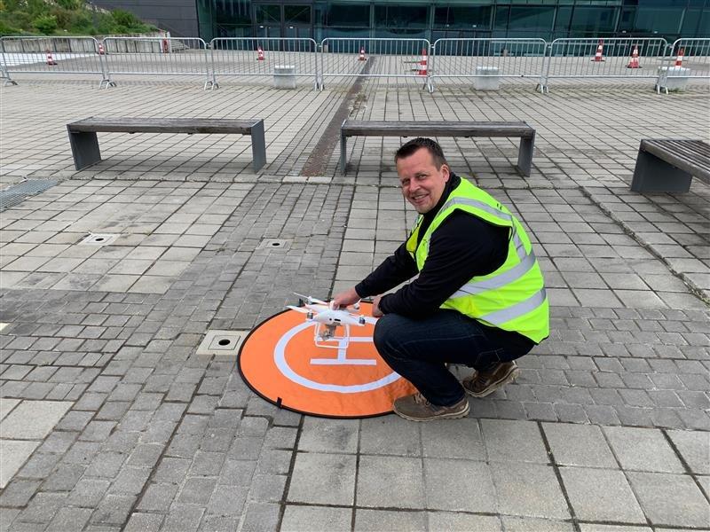
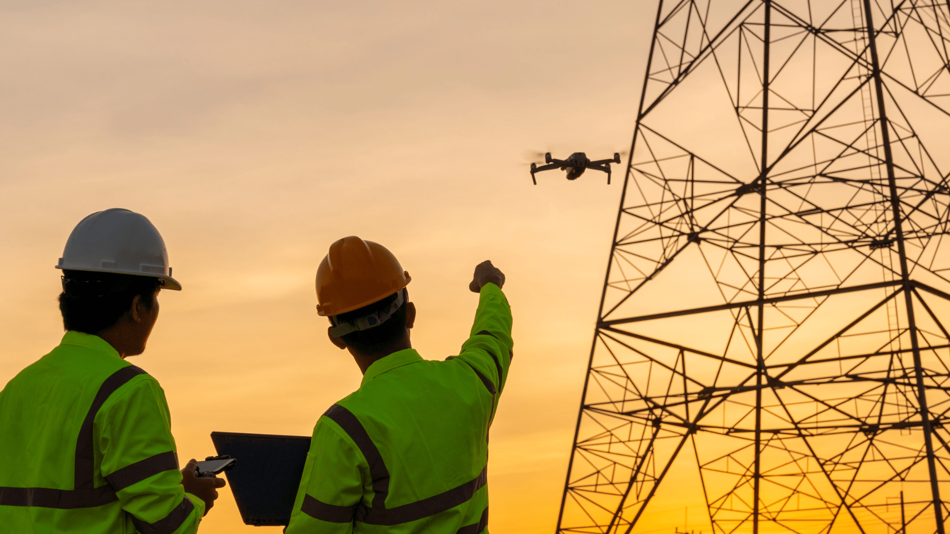
Bild 1: FlyNex Drohnenpilot Christian Georgi startet die Drohne
Digitalisierung durch Luftbilddaten
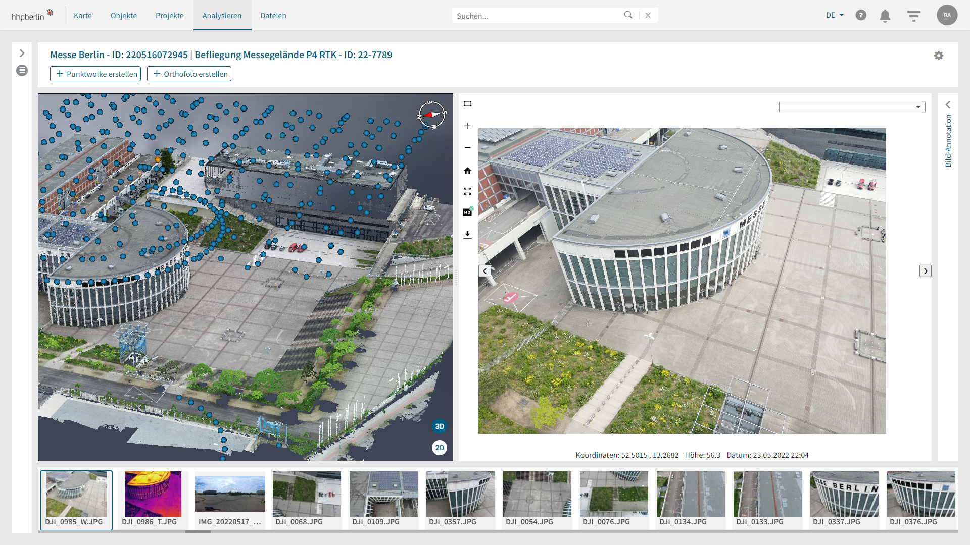
Aber wie lassen sich die rund 20.000 Objekte, bei denen hhpberlin allein in Deutschland für die brandschutzrechtliche Planung und Prüfung beauftragt ist, als digitale Zwillinge erstellen? Die Lösung kommt aus der Luft! Gemeinsam mit FlyNex befliegt hhpberlin das Berliner Messegelände per Drohne und sammelt dabei innerhalb kürzester Zeit hochwertige Luftbilddaten. Dabei wird die Planung, Befliegung und anschließende Analyse gewonnener Daten in der FlyNex Plattform vorgenommen. Nach dem rund 45-minütigen Drohnenflug werden die aufgenommenen Bilder mithilfe der Connect App in die FlyNex Plattform übertragen und dort durch eingebundene Analysetools zu einem digitalen Zwilling weiterverarbeitet. Dieses bildet die Realität auf rund zwei Zentimeter genau ab.
Automatisierte Flugrouten sparen wertvolle Zeit
Doch die Drohnen kommen nicht nur für den präventiven Katastrophenschutz zum Einsatz. Auch im akuten Notfall, beispielsweise bei einem Brand, können die unbemannten Fluggeräte in Kombination mit der FlyNex Software Leben retten. So lassen sich für die Lagesondierung vorprogrammierte Flugrouten nutzen, die vor Ort automatisiert abgeflogen werden. Auf diese Weise können sich die BOS im Ernstfall schnell und zuverlässig ein umfassendes Bild der Situation verschaffen und zielgerichtete Maßnahmen ableiten. Ein enormer Mehrwert, der Zeit spart und über die Rettung von Menschenleben entscheidet.
„Dank der FlyNex Plattform können wir den vorbeugenden Brand- und Katastrophenschutz nun in großem Maßstab digitalisieren. Die Berliner Messe ist das ideale Testobjekt, um den Mehrwert digitaler Zwillinge und automatisierter Flugrouten zu verdeutlichen. Dank der Modelle erhalten BOS schnell einen zuverlässigen Überblick und können gezielt in das Geschehen eingreifen.“
Sie haben Fragen zur Zusammenarbeit mit hhpberlin oder ihrem eigenen Anwendungsfall zur digitalen Erfassung von Infrastruktur? Kontaktieren Sie uns. Wir freuen und auf den Austausch!
Wir wünschen Ihnen gute Flüge!
Ihr FlyNex Team
