MAP2FLY für unterwegs
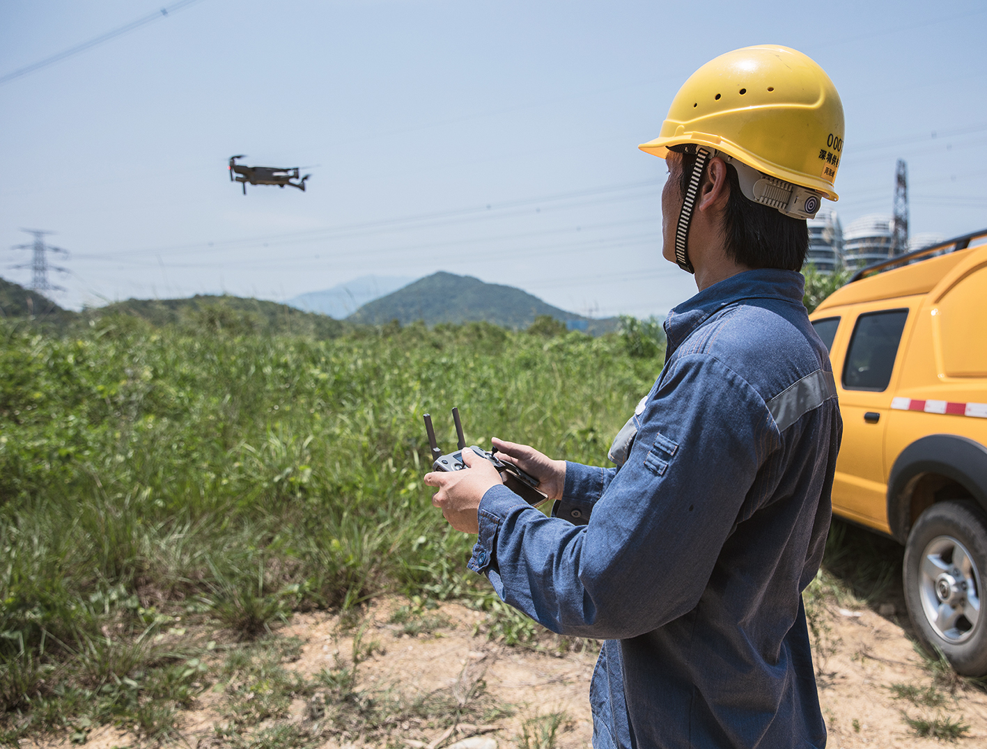
Anfang des Jahres haben wir MAP2FLY als mobile App entwickelt und veröffentlicht. Die kostenlose App kann sich jeder Pilot im Apple Store für iOS oder bei Google Play für Android downloaden. Damit können wir nun den Wunsch vieler Nutzer erfüllen und die umfangreichsten Informationen für den Aufstieg mit Flugmodellen und unbemannten Luftfahrtsystemen als App anbieten. Damit ist jeder Steuerer auch unterwegs bestens gerüstet, wenn man kurzfristig seinen Aufstieg überprüfen möchte. Mit MAP2FLY wollen wir jedem Steuerer einer Drohne ein einfaches und kostenloses Tool an die Hand geben, sodass jeder schnell und einfach beim Fliegen auf der sicheren Seite ist, ohne tausende Seiten Gesetzestexte verstehen zu müssen.
Umfassende Geodaten
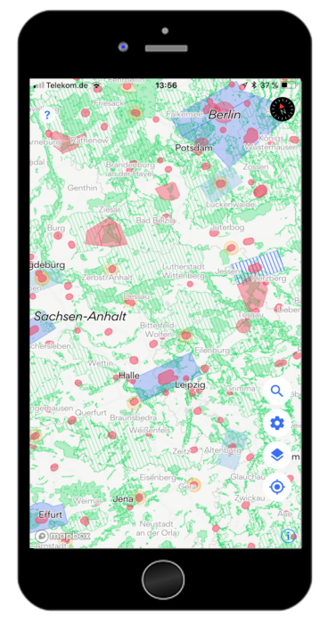
Die besondere Herausforderung in der Entwicklung der App bestand natürlich dabei, die bestmöglichen Informationen und rechtlichen Auflagen anzeigen zu können. Das Besondere an MAP2FLY sind daher die zu Grunde liegenden Geodaten, die den umfangreichsten Bestand für ganz Deutschland abbilden und über die Dauer von nun fast 3 Jahren aus zahlreichen amtlichen Quellen gesammelt, analysiert und aufgebaut wurden. Damit verfügt MAP2FLY über den besten Datenbestand, den man am Markt finden kann, um die genausten Informationen auf Basis der bestehenden Auflagen und Gesetze abzurufen. Aus über 50GB an Geodaten verfügt die App nun allein an 8,5GB an relevanten Geoinformationen, die jedem Piloten nun kostenfrei unterstützen.
Das erste Update der MAP2FLY App
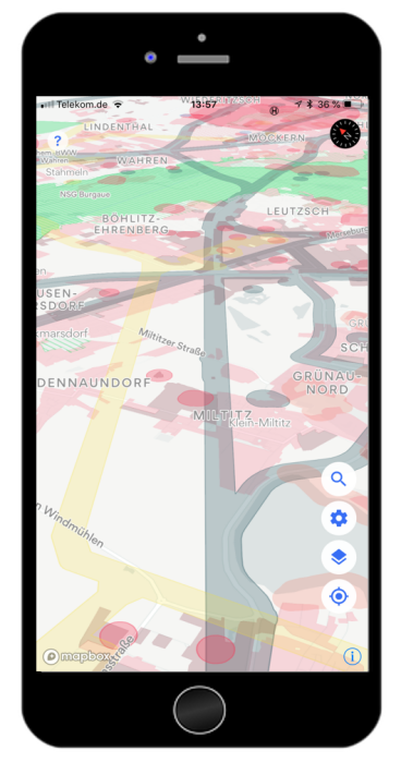
Auf Grund der riesigen Datenmengen die wir verarbeiten mussten, standen wir zu Beginn des Jahres vor mehreren kleinen Kinderkrankeiten. Die Karte war noch sehr langsam und brauchte eine Weile, um die Daten zu laden. Im ersten Update haben wir uns daher daran gemacht, die Performance deutlich zu erhöhen, sodass die Karte nun schnell und flüssig läuft.
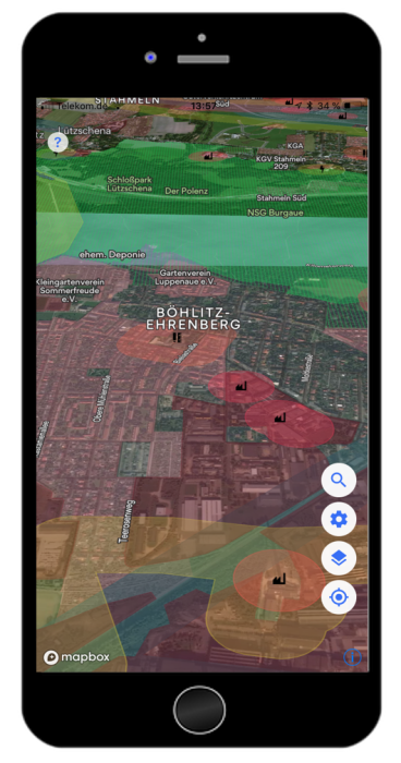
Gleichzeitig haben wir das Update am 25.05.2018 zum Anlass genommen, die Datenlage nochmals deutlich zu verbessern und haben unser größtes Datenupdate vorgenommen, seitdem wir Map2Fly im Frühjahr 2017 gelauncht haben. Mit dem Datenupdate haben wir vor allem nochmal zahlreiche neue offizielle und amtliche Datenquellen einbinden können. Der resultierende offizielle Informationsgehalt ist damit noch besser geworden.
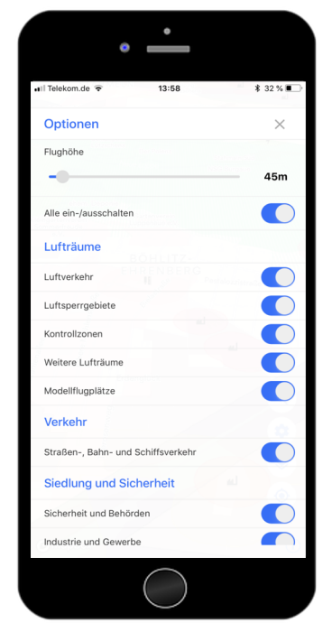
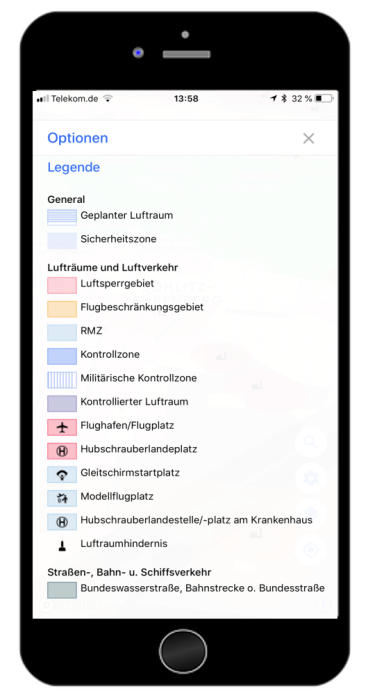
Obwohl nun mehr Daten und mehr offizielle Informationen zur Verfügung stehen, haben wir das Design überarbeitet, die Komplexität reduziert und die Lesbarkeit der Karte einfacher gestaltet. Mit der neuen Legende ist MAP2FLY besser verständlich. Es sind nun auch mehr Kartenlayer verfügbar, die man bei Bedarf und je nach Wunsch aktivieren kann.
Außerdem haben wir natürlich die ersten Bugs gefixt, den Standortdienst verbessert und die Bedienbarkeit flüssiger gestaltet.
Mit der mobile App MAP2FLY erfährt man nun zuverlässig durch die umfangreichsten offiziellen Daten, schnell und leicht verständlich, alles was man beim Aufstieg mit einer Drohne beachten muss.
MAP2FLY setzt den Standard
Nicht nur tausende von Piloten vertrauen auf die MAP2FLY mobile App, sondern auch Internetportale wie CHIP empfehlen die App für alle Drohnenpiloten. Nicht nur wurde die App mit sehr gut bewertet, sondern sie befindet sich auch unter den Top Ten Downloads der Drohnenapps in Deutschland. Damit setzt MAP2FLY nicht nur in Sachen Geodaten für den Markt der unbemannten Luftfahrtsysteme den Standard, sondern hilft alle Drohnenpiloten sicher und stets informiert zu fliegen.
Wir wünschen allen Piloten weiterhin viel Spaß und Erfolg bei allen Projekten
Euer FlyNex Team