Mit der FlyNex Plattform erhalten Sie aktuelle Regeln und Vorschriften nach der EU-Drohnenverordnung sowie dazugehörige Behördendaten zum jeweiligen Fluggebiet. Nutzen Sie hierfür zwei Möglichkeiten:
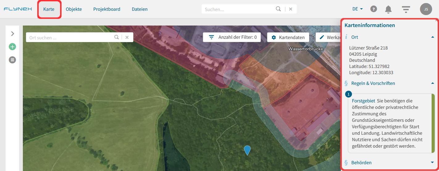
Ausgabe der Informationen direkt auf der Karte:
1) Öffnen Sie die Funktion Karte im Hauptmenü.
2) Suchen Sie den gewünschten Ort auf der Karte.
3) Setzen Sie einen Rechtsklick auf die gewünschte Stelle auf der Karte zur Ausgabe der behördlichen Informationen (Hinweis: Weitere Informationen zu Kartenlayern auf der Karte finden Sie hier).
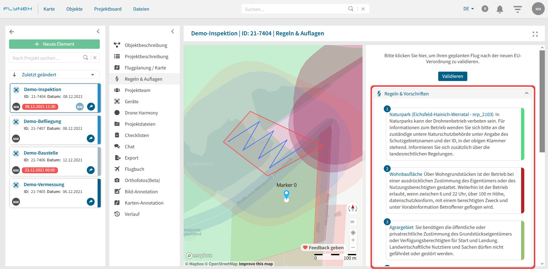
Ausgabe der Informationen für Ihren geplanten Flug im Projekt:
1) Öffnen Sie zunächst ein Projekt.
2) Wählen Sie die Funktion Regeln & Auflagen zur Ausgabe der behördlichen Informationen.
Hinweis: Sollten keine Informationen abrufbar sein, ist es zunächst nötig eine Flugplanung für Ihr Projekt vorzunehmen.