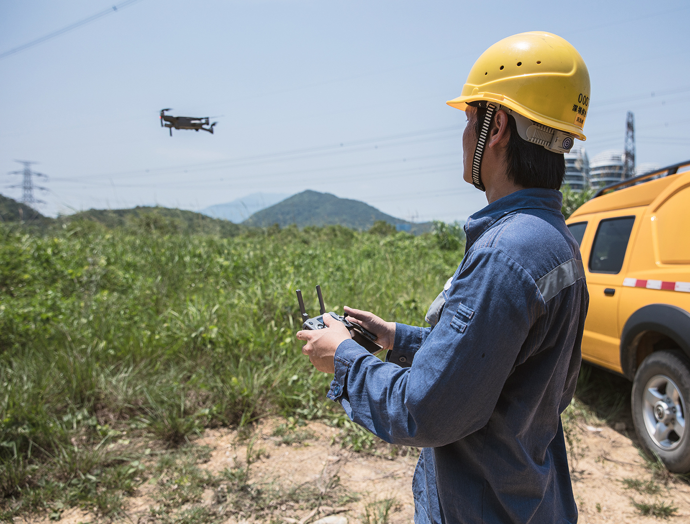
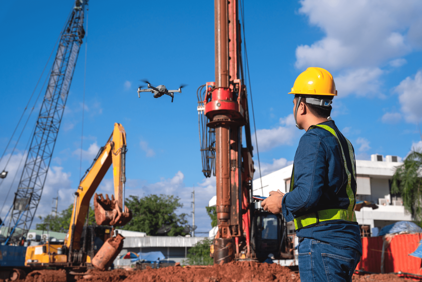
In der Vermessungsbranche sind Drohnen nicht mehr wegzudenken. Sei es im Straßen-, Wohnungs- oder Tagebau. Die Vorteile der Drohne sind vielfältig und haben das Vermessungswesen revolutioniert.
Vorteil Drohne: Effizienz- und Qualitätssteigerung bei gleichzeitiger Kostenreduktion
Durch den Einsatz von Drohnen bei Vermessungen kann sehr viel Zeit eingespart werden. Je größer das Areal, was vermessen werden soll, desto effektiver ist die Drohne im Vergleich zum Vermessungstechniker mit Tachymeter oder GPS-Rover.
Grundverschiedene Herangehensweise bei der Vermessung mit Drohnen
Während der Vermessungstechniker seine Arbeit im Schritttempo (maximal 6 km/h) absolviert, kann die Drohne die Bilder bei 30 km/h oder mehr aufnehmen. Bei unwegsamem Untergrund ist der Geschwindigkeitsunterschied noch höher.
Die Drohne nimmt viele überlappende Fotos auf, die dann im Anschluss per Software zu einem Ganzen, georeferenzierten Orthomosaik zusammengesetzt werden. Diese Technik nennt sich Photogrammetrie.
Der Vermesser hingegen nimmt nur Messpunkte auf. Diese müssen sehr präzise aufgenommen werden, um keine Ungenauigkeiten zu erzeugen. Die Drohne hingegen nimmt Millionen von Messpunkten auf, sodass teilweise die Punktwolken ausgedünnt werden müssen. Durch die Vielzahl an Bildern kann ein 3D-Modell erstellt werden. Der Tachymeter kann indes nur Messpunkte aufzeichnen, keine flächendeckenden Bilder. Dadurch können Größen von Gebäuden festgestellt werden. Die Drohnenbilder erlauben jedoch die Aufzeichnung der Fassaden samt all ihrer Unregelmäßigkeiten, wie Risse, Brüche, etc.
Ergebnisse der Photogrammetrie
Zur Erstellung eines 3D-Modells wird das Verfahren der Photogrammetrie angewendet. Auf diese Weise wird ein digitaler Zwilling beispielsweise eines Gebäudes erstellt. Durch die Georeferenzierung während der Datenerhebung entsprechen alle Größen und Proportionen maßstabsgetreu denen der Realität. Die Modelle werden mit Hilfe sog. Punktwolken erstellt. Am Ende der Erstellung eines Modells wird dieses in einem Dateiformat gespeichert, welches z. B. von einer CAD-Software gelesen und verarbeitet werden kann.

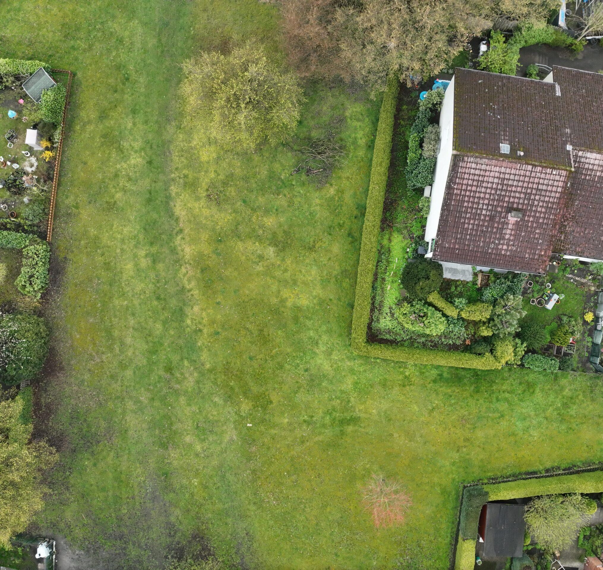
(Gesamtaufnahme des Geländes der Leipziger Spinnerei. Bild: ProCopter GmbH)
Orthofotos
Aus Luftbildern lassen sich dank der Georeferenzierung geometrisch genaue Karten erstellen. Diese sind vor allem in der Stadtplanung und -Entwicklung im Einsatz. In der Vergangenheit wurden solche Bilder mit Flugzeugen oder Satelliten erstellt und waren dementsprechend teuer. Durch den Einsatz von Drohnen können die Kosten deutlich gesenkt werden. Zudem haben die entstandenen Orthofotos einen höheren Detailgrad, weil Drohnen in geringerer Höhe fliegen als Flugzeuge oder Hubschrauber. Sie müssen zwar mehr Bilder machen, aber dadurch ergibt sich eine höhere Auflösung der Gesamtaufnahme.
Steigerung der Genauigkeit durch mehrere Sensoren
Drohnen für den Freizeitbedarf sind meist mit weniger Sensoren ausgestattet, als Drohnen für den professionellen Einsatz. Die Consumergeräte von DJI bieten bereits ausgeklügelte optische Sensoren, die beispielsweise auch Hindernisse erfassen können. Auch GPS ist bei den teureren Freizeitdrohnen mit an Bord, sodass auch Flugrouten abgeflogen werden können. Professionelle Drohnen gehen hier jedoch deutlich weiter. Sie bieten z. B. die Möglichkeit, neben einer RGB-Kamera zusätzlich eine Wärmebildkamera für thermografische Aufnahmen anzubringen. Des Weiteren sind gerade Drohnen für die Vermessung mit RTK-GPS Sensoren ausgestattet. Die RTK-Vermessung ermöglicht dadurch Genauigkeiten von 1-2 cm und eine Auflösung von < 1cm/Pixel. Zum Vergleich: Orthofotos, die durch Flugzeuge gemacht werden, bieten eine Auflösung von 20-40 cm/Pixel.
Drohnen, die nicht über RTK-Sensoren verfügen erreichen allerdings nur eine Genauigkeit von 5-10 cm, wenn zudem keine Passpunkte im Voraus erstellt wurden. Je nach gefordertem Detailgrad muss hier ein Vermessungstechniker mit Tachymeter eingesetzt werden. Dieser erstellt sog. Passpunkte (Ground Control Points – GCP), die zur Bestimmung der Orientierung eines Messbildes erstellt werden müssen. Die Vermessung mit Tachymeter ist die genaueste am Markt. Drohnen bieten jedoch noch einige andere Vorteile.
Vorteile von Drohnen bei unwegsamem Gelände
Neben der besseren Messgenauigkeit bietet der Einsatz von Drohnen bei Vermessungen noch einen Vorteil für die Vermessungstechniker: Sie müssen das Gelände nicht mehr vollständig abgehen.
Dies bringt neben dem bereits genannten Zeitvorteil auch eine Erhöhung der Sicherheit. Gefahrengebiete oder schwer zugängliche Orte können ohne Risiko für den Vermesser überflogen werden. Gerade im Tagebau ist dies ein großer Sicherheitsgewinn.
Praxisbeispiel: Interview mit Frank Lochau von der ProCopter GmbH
Um zu verdeutlichen, wie ein Drohneneinsatz bei einer Vermessung abläuft, möchten wir einen Auftrag skizzieren. Hierfür konnten wir Frank Lochau, seines Zeichens Geschäftsführer der ProCopter GmbH und Vorstandvorsitzender des Branchen Verband für zivile Drohnen (BVZD), gewinnen. ProCopter bietet Dienstleistungen rund um die Befliegung mit Drohnen an. Diese reichen von der Vermessung über Thermographieaufnahmen bis hin zu Eventreportagen und Werbefilmen.
Die ProCopter GmbH bietet zahlreiche Services mit Drohnen an. Was ist momentan gefragt?
Frank Lochau (FL): Momentan liegt der Schwerpunkt unserer Aufträge ganz klar bei Vermessungen. Hierbei liegt der Fokus ganz klar bei der Erstellung von 3D-Modellen und den daraus entstehenden digitalen Zwillingen von realen Objekten. Weitere Einsatzbereiche sind Vermessungen von Oberflächen, Geländen und Fassaden von Gebäuden. Dicht dahinter folgen die Sichtinspektionen mit Wärmebildkameras von Photovoltaikanlagen. Eventreportagen, wie z.B. Hochzeiten finden meist nur in den Sommermonaten statt. Bilder, die mit der Drohne gemacht werden, sind zwar gefragt, aber nur als Extra zur eigentlichen Reportage.
Kommen wir zu den Auftraggebern. Aus welchen Branchen stammen diese? Gab es Veränderungen in letzter Zeit?
FL: Unsere Auftraggeber stammen vermehrt aus dem B2B-Bereich. Die meisten Kunden sind aus dem Bereich der Energieversorgung und dem Hoch- und Tiefbau. Seit ca. einem Jahr beobachten wir ein steigendes Interesse in der Industrie. Zudem steigt das Marketing der Drohnenhersteller, welches wiederum in den einzelnen Branchen Interesse weckt, Drohnen in ihre Arbeitsprozesse zu integrieren.
Bei Vermessungen sind Drohnen nicht mehr wegzudenken. Können Sie uns sagen, wie die einzelnen Arbeitsprozesse lauten?
FL: Hierfür würde ich gerne den Ablauf bei einem jüngst absolvierten Auftrag skizzieren. Auf dem Gelände der Leipziger Spinnerei befindet sich ein Schornstein, der vermessen werden sollte. Zuerst wurde mit dem Kunden gemeinsam abgestimmt, was der Kunde mit den erhobenen Daten erreichen möchte. Hierbei ist es wichtig zu erfahren, welche Genauigkeiten eingehalten und in welcher Auflösung die Daten erhoben werden sollen. Wir entschieden uns, bei der Befliegung großzügig Bilder aufzunehmen, so dass auch Teile des angrenzenden Gebäudes mit aufgenommen wurden. Dies ist ein gängiges Verfahren bei der Vermessung mit Drohnen, da so ein besserer räumlicher Bezug entsteht. Nachdem die technischen Grundvoraussetzungen mit dem Kunden abgesprochen wurden, begann die Flugplanung.
Wir verwenden seit einiger Zeit MAP2FLY, um unsere Flugrouten zu prüfen. Wir erhalten mit wenigen Klicks direkt eine Auflistung aller Gesetze und Regeln, die auf der Route gelten und können so direkt abwägen, ob ein Flug überhaupt genehmigt werden kann. In diesem Fall wurde in MAP2FLY nur angezeigt, dass es sich um ein Industriegelände handelt, welches man nur mit der Genehmigung des Eigentümers befliegen darf. Diese wurde eingeholt und so stand einer Fluggenehmigung nichts mehr im Wege. Eine explizite Genehmigung durch die Behörden ist in diesem Fall nicht notwendig, da eine Allgemeinverfügung für Sachsen vorliegt, die die Voraussetzungen für diesen Fall reguliert. Bevor die Genehmigung angefragt wird, wird mit dem Kunden ein Termin zur Befliegung verabredet. Hierfür ist natürlich ein Blick in die Wettervorhersage obligatorisch.
Wie ist die Vorgehensweise am Tag der Befliegung?
FL: Am Tag der Befliegung treffen wir meist den Kunden direkt Vorort. In diesem Fall hatte der Kunde die schriftliche Genehmigung des Anlageneigentümers dabei. Zudem erstellten wir mit Hilfe eines Tachymeters ca. 30 Messpunkte am Schornstein, da unser Kunde ein 3D-Modell erhalten wollte, welches sehr genau ist.
Das Wetter passte auch, so dass wir mit der Befliegung starten konnten. Den Flugplan haben wir in diesem Fall mit Pix4D erstellt und auf die Drohne geladen, um das umliegende Gelände zu erfassen. Der Schornstein selbst, wurde manuell beflogen. Dies vereinfacht das Abfliegen der Flugroute. Nachdem die Drohne fertig war, konnte die Auswertung der Daten beginnen.

(Nahaufnahme des 3D-Modells des Schornsteins an der Leipziger Spinnerei. Bild: ProCopter GmbH)
Das ist die perfekte Überleitung zu unserer nächsten Frage: Was machen Sie mit den entstandenen Aufnahmen?
FL: Die Bilder werden zuerst auf einen Computer überspielt. Am Computer wird mit Hilfe von Adobe Lightroom eine Anpassung der Belichtungen der einzelnen Aufnahmen durchgeführt. Zudem führen wir eine Objektivkorrektur durch und exportieren die aufgearbeiteten Bilder. Im Anschluss kann die Verarbeitung beginnen. Hierbei gibt es zwei Vorgehensweisen. Zum einen können wir die Bilder mit einem Cloudanbieter berechnen lassen. Dies ist recht schnell und günstig. Leider ist diese Art der Datengenerierung für einige Zwecke jedoch zu ungenau. Wenn der Kunde wert darauflegt, präzise Daten zu erhalten, erstellen wir die 3D-Modelle selbst. Hierzu haben wir eine Photogrammetrie-Software, in der wir, anders als über den Clouddienst, viele Einstellungen selbst vornehmen können. Wir räumen Punktwolken auf, können die ausgewerteten Daten an die Software des Kunden anpassen und die Bereiche, die berechnet werden sollen, selbst wählen. Die Wahl der Auflösung der 3D-Modell hängt vom sog. Polygon-Budget des Kunden ab. Durch die genauere Auswertung und den höheren Aufwand ist die Analyse durch uns selbst natürlich kostenintensiver, als die Cloudlösung. Der Vorteil ist aber die Anpassbarkeit. Clouddienste bieten diese Möglichkeit bisher nicht.
Wie kommt der Einsatz der Drohne bei Ihren Kunden an?
FL: Unsere Kunden sind prinzipiell sehr an unserer Arbeit interessiert. Viele möchten bei der Befliegung dabei sein. Die richtige Begeisterung kommt mit der Auswertung der Daten. Die Erstellung der 3D-Modelle ist häufig schnell erledigt und der hohe Detailgrad hat bisher all unsere Kunden überzeugt.
Inwieweit hilft Ihnen MAP2FLY bei Ihren Projekten?
FL: MAP2FLY hat unsere Arbeit revolutioniert! Vorher mussten wir mühselig (Flug-)Karten lesen und manuell prüfen, ob auf unseren Flugrouten behördliche Gebäude lagen, die nicht überflogen werden durften. Jede Auflage musste geprüft werden was pro Flug bis zu 5 Stunden oder mehr gekostet hat. Mit MAP2FLY schaffen wir eine komplette Planung in 30 Minuten. Die reine Prüfung auf Verbote und Auflagen ist meist sogar in wenigen Minuten erledigt.
Wir bedanken uns an dieser Stelle an Frank Lochau für das Interview!
Wir hoffen, dass wir einen kleinen Einblick in die tägliche Arbeit mit Drohnen bei Vermessungen geben konnten.
Wer Interesse bekommen hat, MAP2FLY zu testen, kann unsere Software gerne kostenlos ausprobieren.
Ihr FlyNex Team