Case Study MITNETZ STROM
Erfolgreiche Inspektion von Stromtrassen mit einer Drohne
Zusammenfassung
Stromnetze einfach mit Drohnen inspizieren
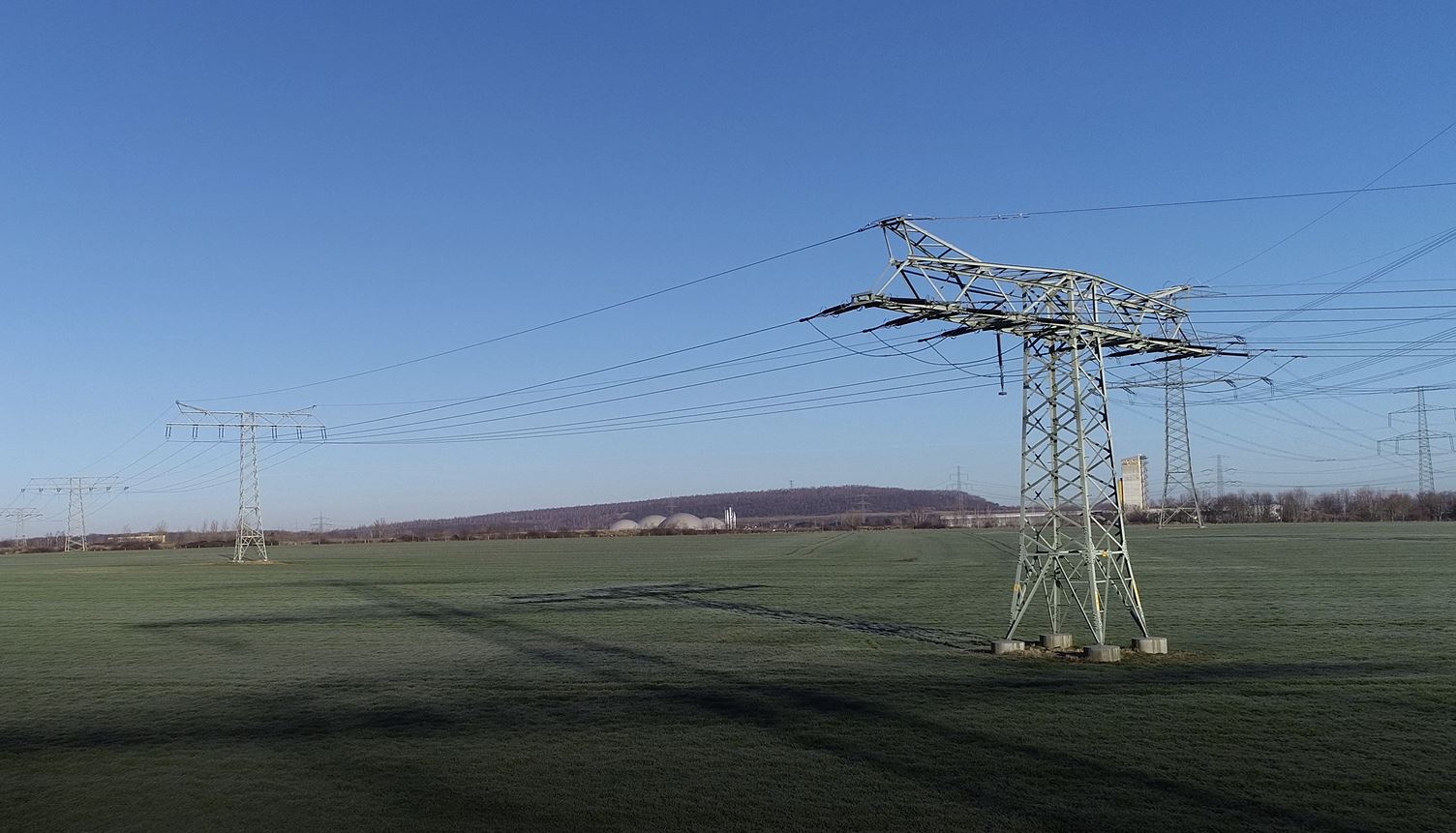
Anfang 2020 beflog MITNETZ STROM als Energienetzbetreiber südlich von Leipzig erstmalig Stromleitungen über eine Strecke von 40 Kilometern mit einer Drohne. Als erste Befliegung dieser Art flog die Drohne außerhalb der Sichtweite, ohne dass ein menschlicher Eingriff notwendig war. Insgesamt 70 Strommasten kontrollierte das Fluggerät mit einer Kamera, um Seilschäden, Vogelnester und Systemnummern der Strommasten zu erfassen. Zu diesem Zweck kam eine Künstliche Intelligenz zum Einsatz, die selbstständig die Auswertung der Aufnahmen durchführte. Was bislang als technisch unmöglich galt, wurde innerhalb kürzester Zeit südlich von Leipzig nachweislich umgesetzt.
Über 20 Experten haben gemeinsam an dem Projekt gearbeitet. Unter anderem konzipierten Geo-Wissenschaftler, Piloten und Drohnen-Spezialisten von FlyNex die Erst-Befliegung innerhalb von drei Monaten von der Idee bis zur Umsetzung gemeinsam mit MITNETZ STROM. Monaten. Die Idee dahinter: In Zukunft automatisierte Inspektionsflüge von Drohnen in ganz Deutschland durchführen zu können. Dazu wurde die Enterprise Suite von FlyNex für die Planung und Befliegung der Drohne genutzt.
Während des 45-minütigen Einsatzes konnte MITNETZ STROM den Flug im Livestream nachverfolgen. Neben den Projekt-Teams von MITNETZ STROM und FlyNex, waren auch Medien und Anwohner vor Ort, um den Einsatz zu beobachten.
Geflogen wurde mit einem speziellen Oktokopter, einer 8-rotorige Drohne, die während des Fluges über 60 Bilder pro Minute erstellte. Eine künstliche Intelligenz wertete die Aufnahmen anschließend direkt aus. Verschiedenste Masttypen und unterschiedliche Gegebenheiten am Boden, wie Wald-, Wohn- und Gewerbegebiete machten dieses Projekt in seiner Form sehr spannend.
Fakten & Zahlen
- Eingesetztes Gerät: Oktokopter, 8-rotorige Drohne
- Geschwindigkeit: ca. 15 km/h
- Flughöhe zwischen 25 und 60 m, abhängig von der Masthöhe
- Aufnahme von 60 Bildern pro Minute
- Inspektion von 70 Strommasten zwischen Zwenkau und Eula
- Insgesamt wurden ca. 40 Kilometer Leitungsstrecke beflogen
- Ziel: Aufnahmen von Seilen, Masten, Traversen und Systemnummer zur KI-gestützten Bild-Analyse
White Paper „Managed Drone Operations“
Finden Sie weitere Informationen und Details zur Lösung von FlyNex in unserem aktuellen White Paper Managed Drone Operations in Enterprise-Umgebungen.
Projektpartner