Unmanned aerial systems, also known as drones, are currently in most cases remotely controlled by a controller or pilot. The main reasons for the development of drones are the demand for greater safety, precision and, above all, a simpler performance of conventional work. This work can be maintenance work or the inspection of vertical objects, for example. This includes towers, antennas, power poles, and wind turbines.
Although drones are being used in the military, today we are mainly talking about civilian applications in the economy and for the leisure segment. The market initially experienced initial growth in the hobby drone segment. In the meantime, however, more and more industrial applications can be found which help users to obtain more information and knowledge. One reason for this is also the price drop for the necessary hardware.
Today there is software for flight planning and more
Drones vary in size, shape, and core elements or assemblies (battery, number of rotors, and type of sensors). However, the drones, which currently cover most commercial applications, are similar in design. Since many elements from smartphones and other mobile devices are also located in the drones, they can be referred to as flying smartphones or computers. The miniaturization of cameras and sensors is turning drones into dynamic detectors that can deliver a wide variety of data. That data can also be distributed and processed over the Internet. New software solutions and applications are created based on data collection possibilities. Innovative business models are establishing themselves and the focus lies on the analysis of the collected data. A drone is a smart tool and already there´s availability for drone maps, flight planning software, drone insurances and a number of marketplaces where pilots and clients can come together.
With their software solutions, these companies enable early adopters to bring drones into the air. The selection of the right equipment, pilot training, flight planning and the entire project management with drones all require extensive expertise. However, drones can reduce the time and cost and also the deployment of staff, especially in safety-critical scenarios. The quality of the data analysis improves, and companies can develop new business areas on that basis.
Secure new business areas early on and exploit the added value
One example is providers from the telecommunication sector. They can now offer services that do not initially concern their core business but will become increasingly relevant in the future. Verizon, for example, bought the start–up Skyward in 2017 to be part of a future drone aviation solution. This will enable Verizon to participate in the processing and forwarding of the resulting data and secure a firm role in a rapidly growing market. Simply put, drones serve as flying tool carriers in industrial applications. However, these tools can generate knowledge and data from a completely new perspective.
Added value through the use of drones
- Time-saving
- Cost-saving
- Development of new business fields
- Participation in new application areas, services, etc.
- Work risk reduction
- High-resolution image and video recording
- Achieving new perspectives for data acquisition
- Easier access to inaccessible places
- Better negotiating position with suppliers and service providers thanks to better data
Seven industries in a pioneering role
Currently, seven industries can be identified that are already testing and using drones in various scenarios. In the following, typical applications and the respective advantages for the branches of industry are explained. We are just scratching the tip of the iceberg in terms of exploiting drone technology for industrial applications and the way the job is done.
Construction
The use of drones is particularly suitable in the construction industry because larger and unclear areas are often worked on. Some areas are difficult to access, require a great deal of effort for inspections and pose a certain safety risk for people.
However, drones can also be used for:
- Monitoring security preparations
- Performing terrain surveys for GIS mapping with radar and laser systems
- Improving coordination for multiple teams
- Documenting construction progress for further planning and the customer
Further information on the construction industry can be found under the following link

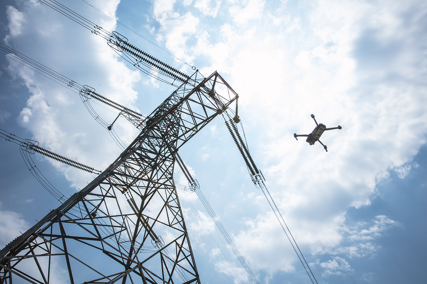
Energy
In the energy industry, application scenarios for inspection and site investigation play a decisive role. Reducing the risk and saving time during an inspection are the essential factors. In addition, digital data can be obtained comparatively fast and is suitable for documenting changes. Overhead lines, solar power plants, wind power plants, hydroelectric power plants, and oil pipelines are among the most frequently inspected systems by drones. However, drones are also used for area exploration and mapping. For the flying and inspection of power pylons, there is also an application example on our blog. In addition, drones provide more effective and efficient data than traditional methods. One example is the thermographic assessment of solar systems. For a solar plant in the order of 5 MW (26,000 modules) 3 people are necessary, who examine the panels with portable devices. If the sun is behind them, their shadows can lead to inaccurate results. This problem can be solved with drones, for example. In addition, flying is many times faster.
Further information on the use of drones in the energy industry can be found at the following link.
Inspection services
According to a 2017 study by the consulting firm PwC, the area of inspection services will be the one with the greatest growth in turnover. UAVs are particularly valuable for inspection and maintenance work in hard-to-reach areas or in contaminated environments. They can also be used for aerial photo analysis of buildings and other infrastructures such as pipelines, solar parks, overhead lines, and offshore platforms. Thermal imaging cameras can be attached to drones to detect “hotspots” on solar collectors where energy is not transmitted properly. Rapid identification of potentially damaged areas can increase system productivity.
Drones have also proven useful for insurance companies in the aftermath of natural disasters. They act as a kind of insurance for insurers. They provide a quick, accurate and efficient way to identify causes of damage, clarify liability issues and assess the total loss.
Media/ Film
Drones have been used in the media and film environment for quite some time. The prices for powerful devices have been drastically reduced over time. The drones are now easier to fly and easier to transport. The main advantage is that they can film from angles and perspectives that were previously only possible at great expense. Drones are being used more and more for advertising, image videos, documentaries, and journalism. However, every new project still has to be planned and prepared with great effort before it can be implemented. This limits the flexibility and dynamics of drone use.
Real estate industry
More and more real estate companies are using drones to inspect their properties and carry out damage inspections and land surveying. They document the results and now have more reliable data that can be processed furthermore. This enables them to digitally access the condition and inventory data of the real estate portfolio. Changes to the objects can thus be traced more easily.
Furthermore, the recordings and evaluations of drones are used for value appraisals and the creation of object presentations. Also interesting in this context is the use of drones for the security of objects or to supplement the perimeter protection of industrial sites.
Agriculture and Farming
If you think of smart farming, drones are already an integral part of modern agriculture today. In order to digitize agriculture and make it more profitable with data analysis, the first step is to collect the crucial data. With the help of drones, it is possible to quickly and, in part, automatically identify maturity levels or irrigation conditions across large areas. For example, the density and intensity of plant growth can be monitored by means of spectral reflections of sun rays using the procedures in the topic complex of the normalized differentiated vegetation index (NDVI). Without having to be in the vicinity of the areas, detailed information can be obtained in a short time. Today’s programs can give farmers recommendations for fertilization, irrigation and much more.
Thermal imaging cameras can also be used to detect disease-related changes in the plant population at an early stage and to use pesticides in a targeted manner. Targeted use of pesticides saves money and protects the environment – in the spirit of precision farming.
In the agricultural sector, however, not only can data be collected with drones, but the sowing and application of pesticides themselves can also be carried out with drones.
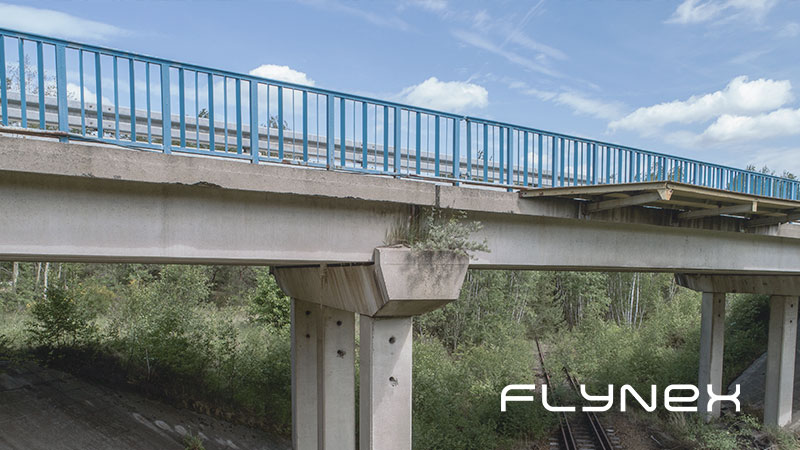
Surveying
In the field of surveying, flying with drones makes work much easier, especially with buildings that are difficult to access or large industrial plants. Using drones creates measurements of particularly high quality and thus can enable the exact modeling of buildings, bridges or factory plants, for example. Furthermore, orthophotos and point clouds can be used to create very accurate 3D models, but also plans and overview maps can be generated.
For whom is the use of drones suitable and how does the entry succeed?
For whom does the use of drones already promise a great added value for his business activities? They are entrepreneurs who are prepared to embrace new technologies, new challenges and changes in work processes and to prepare their company for future developments. Because in a constantly changing and innovative environment, companies are facing major changes.
Companies that collect data in any form, carry out inspections and monitoring or work with film and image data are basically suitable. Numerous examples have already been listed in this text.
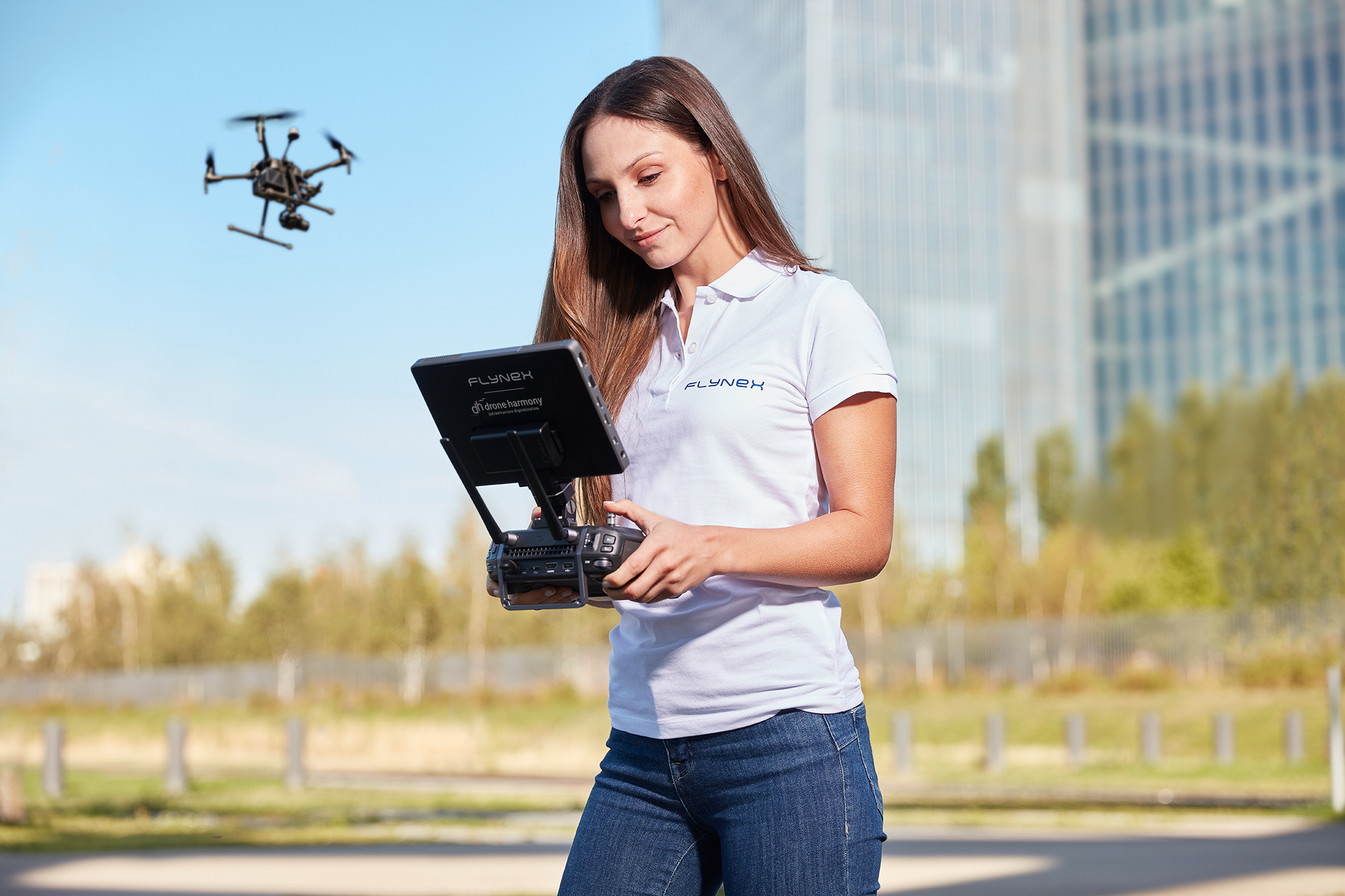
First, human and financial resources need to be available and scheduled to begin a first use case. It is advisable to start by obtaining information from experts on what to look for when selecting, planning, and implementing the first use case. Specialized companies, such as FlyNex, help companies to use drones independently. It is not necessary to buy your own drones and train pilots. Companies can go through the complete value-added process and experience how high the added value is using their own concrete example. Further Use Cases and employment scenarios open afterward almost by themselves.
However, the expectations of the first use case should not be set too high. A first use case should not be too complex and provided with a clear goal. In addition, one should fall back on the experience, which other enterprises already made with the employment of drones. Expert support always makes sense right from the start to ensure that projects run smoothly. Subsequent corrections or cumbersome adjustments and procurements are known to be very expensive.
Your support
Are you interested in the identification of first use cases and would you like to participate in the advantages of flying tools with your company? Then get in touch with us. We look forward to a non-binding discussion with you.
Try out Map2Fly_Pro today and save valuable time for planning your projects. Share and manage your projects with your customers and project partners and benefit from the advantages of using drones even without prior knowledge.
Do you want to stay up to date with drone applications? Then sign up today for our newsletter on flynex.io.
The FlyNex Team