Project DaViLuS
Data Visualisation Of Airspace Structure
Executive Summary
The German Drone-Airspace as a 3D Map
The safe and economic integration of UAS into the airspace is omnipresent both nationally and internationally but is only poorly explored from a data processing and visualization perspective. Unlike in previous aviation, the infrastructure to be created for the lower airspace is largely determined by ground-based infrastructure. This infrastructure on the ground leads to the creation of new airspaces of a very differentiated type and number due to applicable laws and the nature of the objects.
DaViLuS aims to develop a technical solution that maps the necessary airspace infrastructure according to the legal situation based on the comprehensive geodata situation and visualizes it in 3D in a way that is understandable for authorities, companies, and consumers. In addition, the acceptance criteria and user experience for the created and visualized airspaces will be empirically tested. FlyNex validates the comprehensive current data situation including the metadata, especially for unmanned aviation and analyses the geodata against the background of usability and relevance for unmanned aviation. As a result, the airspace infrastructure is referenced in 3D and published.
For this purpose, the consortium works closely together with HERE and numerous authorities. The Institute for Unmanned Systems of the Northern Business School will empirically test the created airspaces regarding acceptance criteria and evaluate the user experience based on the visualization. The project result can be found at https://davilus.flynex.de/.
Facts & Figures
- Almost 360,000 km² of airspace (357,386 km²) was digitally visualized
- Total implementation of the project in less than a year
- An AI-supported routing algorithm for automatic 3D calculation
- More than 165 validated data sources for geographic and spatial information
- Additional 34 UAS area layers in 2D and 3D
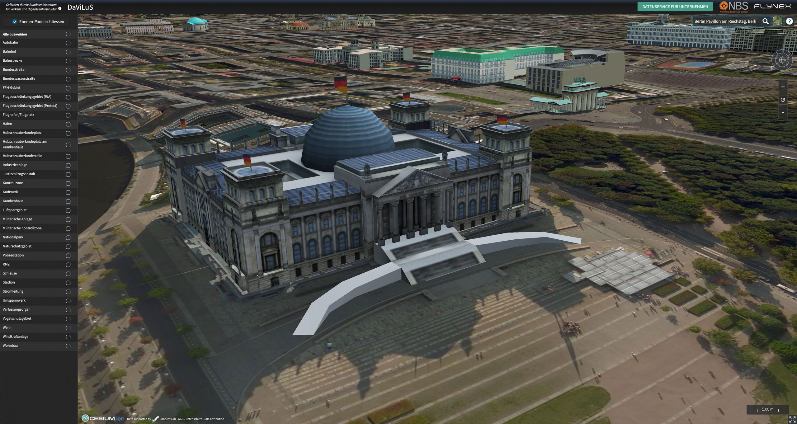
- Textured 3D building models, like the Cologne Cathedral or the Reichstag building in Berlin

By loading the video, you agree to Vimeo's privacy policy.
Learn more
2D Routing Algorithm for navigating through the airspace. In preparation for UTM, 3D mapping, and airspace navigation services.
ProjeCt partner